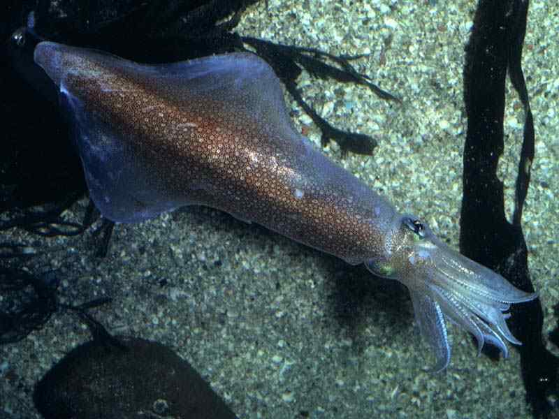
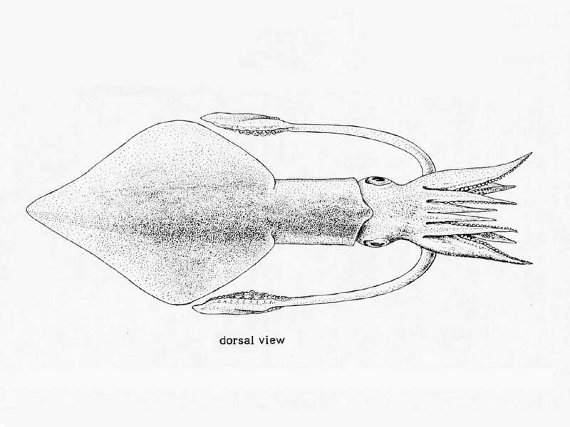
Long finned squid (Loligo forbesii)
Distribution data supplied by the Ocean Biodiversity Information System (OBIS). To interrogate UK data visit the NBN Atlas.Map Help
| Researched by | Emily Wilson | Refereed by | This information is not refereed |
| Authority | Steenstrup, 1856 | ||
| Other common names | Veined squid | Synonyms | Loligo forbesi |
Summary
Description
Recorded distribution in Britain and Ireland
All British and Irish coasts.Global distribution
Eastern Atlantic (20 degrees N to 60 degrees N), the Azores and West African coast south to the Canary Islands (its southern boundary is unknown), the Mediterranean Sea and the Red Sea.Habitat
Found over sandy and muddy bottoms. Migrate to shallows for spawning. During the day they aggregate near the bottom and at night they disperse in the water columnDepth range
10 - 400 mIdentifying features
- Mantle long, moderately slender, cylindrical.
- Fins rhomboid, their length three quarters that of the mantle, their posterior borders slightly concave.
- Tentacle club with median suckers only slightly larger than those on edges.
- Colour - variable but pink, red and brown predominate.
Additional information
Also commonly known as the veined squid.Listed by
- none -
Bibliography
Campbell, A., 1994. Seashores and shallow seas of Britain and Europe. London: Hamlyn.
Hayward, P., Nelson-Smith, T. & Shields, C. 1996. Collins pocket guide. Sea shore of Britain and northern Europe. London: HarperCollins.
Howson, C.M. & Picton, B.E., 1997. The species directory of the marine fauna and flora of the British Isles and surrounding seas. Belfast: Ulster Museum. [Ulster Museum publication, no. 276.]
Roper, C.F.E., Sweeney, M.J. & Nauen, C.E., 1984. FAO species catalogue. Vol. 3. Cephalopods of the world. An annotated and illustrated catalogue of species of interest to fisheries. FAO Fisheries Synopsis, 125, 3, 277. Avaliable: http://www.fao.org/docrep/009/ac479e/ac479e00.htm
Datasets
Bristol Regional Environmental Records Centre, 2017. BRERC species records recorded over 15 years ago. Occurrence dataset: https://doi.org/10.15468/h1ln5p accessed via GBIF.org on 2018-09-25.
Conchological Society of Great Britain & Ireland, 2018. Mollusc (marine) data for Great Britain and Ireland - restricted access. Occurrence dataset: https://doi.org/10.15468/4bsawx accessed via GBIF.org on 2018-09-25.
Conchological Society of Great Britain & Ireland, 2023. Mollusc (marine) records for Great Britain and Ireland. Occurrence dataset: https://doi.org/10.15468/aurwcz accessed via GBIF.org on 2024-09-27.
Kent Wildlife Trust, 2018. Kent Wildlife Trust Shoresearch Intertidal Survey 2004 onwards. Occurrence dataset: https://www.kentwildlifetrust.org.uk/ accessed via NBNAtlas.org on 2018-10-01.
NBN (National Biodiversity Network) Atlas. Available from: https://www.nbnatlas.org.
OBIS (Ocean Biodiversity Information System), 2025. Global map of species distribution using gridded data. Available from: Ocean Biogeographic Information System. www.iobis.org. Accessed: 2025-08-08
Citation
This review can be cited as:
Last Updated: 06/11/2006


