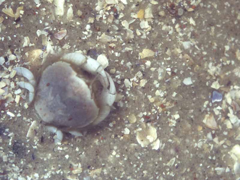
Thumbnail crab (Thia scutellata)
Distribution data supplied by the Ocean Biodiversity Information System (OBIS). To interrogate UK data visit the NBN Atlas.Map Help
| Researched by | Emily Wilson | Refereed by | Admin |
| Authority | (Fabricius, 1793) | ||
| Other common names | - | Synonyms | Thia polita (Fabricius, 1793) |
Summary
Description
Recorded distribution in Britain and Ireland
Recorded at Moray Firth, Plymouth, Channel Isles, Scilly Isles, Carmarthen Bay, Cardigan Bay, Anglesey, Liverpool Bay, Isle of Man and Galway Bay.Global distribution
-Habitat
Burrows in sand and mud from low water to about 45 m.Depth range
-Identifying features
- Carapace slightly brader than long, strongly convex transversely, dorsal surface smooth, margins densely setose.
- Frontal region arched, orbits and eyes very small.
- Antero-lateral margins of carapace with three or four indistinct teeth.
- Chelipeds equal, slightly compressed.
Additional information
Also commonly known as the polished crab.Listed by
- none -
Bibliography
Hayward, P., Nelson-Smith, T. & Shields, C. 1996. Collins pocket guide. Sea shore of Britain and northern Europe. London: HarperCollins.
Hayward, P.J. & Ryland, J.S. (ed.) 1995b. Handbook of the marine fauna of North-West Europe. Oxford: Oxford University Press.
Howson, C.M. & Picton, B.E., 1997. The species directory of the marine fauna and flora of the British Isles and surrounding seas. Belfast: Ulster Museum. [Ulster Museum publication, no. 276.]
Ingle, R.W., 1980. British Crabs. Oxford: British Museum (Natural History), Oxford University Press.
JNCC (Joint Nature Conservation Committee), 1999. Marine Environment Resource Mapping And Information Database (MERMAID): Marine Nature Conservation Review Survey Database. [on-line] http://www.jncc.gov.uk/mermaid
Picton, B.E. & Costello, M.J., 1998. BioMar biotope viewer: a guide to marine habitats, fauna and flora of Britain and Ireland. [CD-ROM] Environmental Sciences Unit, Trinity College, Dublin.
Datasets
NBN (National Biodiversity Network) Atlas. Available from: https://www.nbnatlas.org.
OBIS (Ocean Biodiversity Information System), 2025. Global map of species distribution using gridded data. Available from: Ocean Biogeographic Information System. www.iobis.org. Accessed: 2025-07-30
Citation
This review can be cited as:
Last Updated: 13/05/2008


