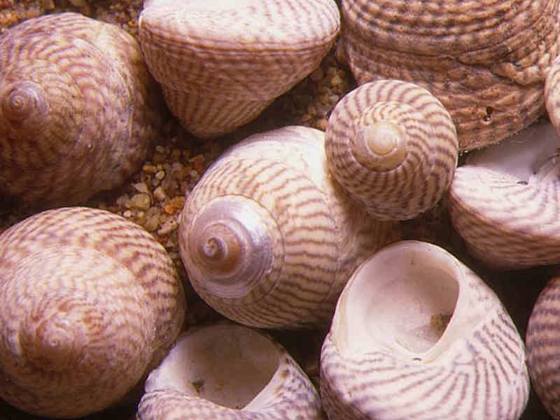
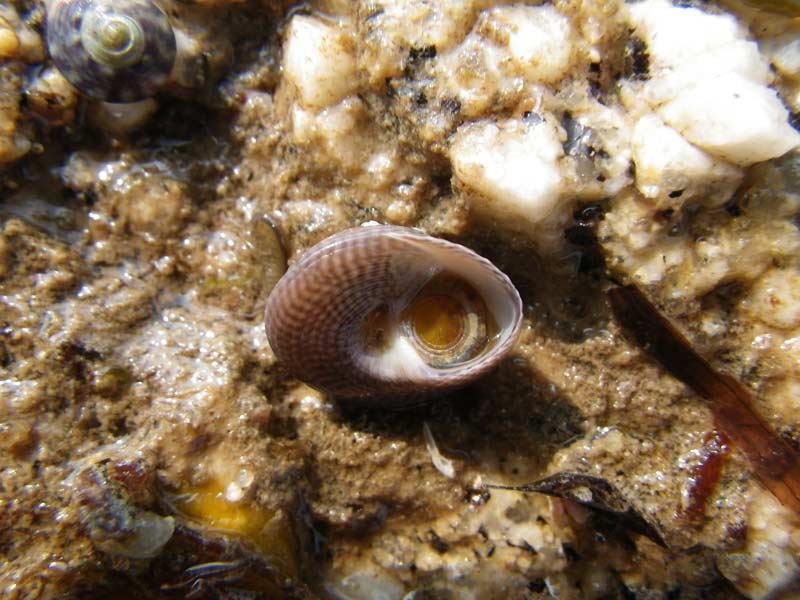
Grey top shell (Steromphala cineraria)
Distribution data supplied by the Ocean Biodiversity Information System (OBIS). To interrogate UK data visit the NBN Atlas.Map Help
| Researched by | Paolo Pizzolla | Refereed by | Admin |
| Authority | (Linnaeus, 1758) | ||
| Other common names | - | Synonyms | Gibbula cineraria (Linnaeus, 1758) |
Summary
Description
Recorded distribution in Britain and Ireland
Common to all British and Irish coasts.Global distribution
-Habitat
It is found on the lower levels of rocky shores on weed and under stones to a depth of 130 m sublittorally. It is sometimes found in rock pools higher on the shore.Depth range
-Identifying features
- Small topshell with a bluntly conical shell up to 1.5 cm high and 1.7 cm across.
- Oval-shaped umbilicus.
- Shell has 5-6 whorls.
- Grey to light yellowish in colour with broad reddish-brown to purple stripes.
Additional information
In Devon and Cornwall, the umbilicus may be covered by the inner lip.Listed by
- none -
Bibliography
Fish, J.D. & Fish, S., 1996. A student's guide to the seashore. Cambridge: Cambridge University Press.
Hayward, P., Nelson-Smith, T. & Shields, C. 1996. Collins pocket guide. Sea shore of Britain and northern Europe. London: HarperCollins.
Hayward, P.J. & Ryland, J.S. (ed.) 1995b. Handbook of the marine fauna of North-West Europe. Oxford: Oxford University Press.
Howson, C.M. & Picton, B.E., 1997. The species directory of the marine fauna and flora of the British Isles and surrounding seas. Belfast: Ulster Museum. [Ulster Museum publication, no. 276.]
JNCC (Joint Nature Conservation Committee), 1999. Marine Environment Resource Mapping And Information Database (MERMAID): Marine Nature Conservation Review Survey Database. [on-line] http://www.jncc.gov.uk/mermaid
Picton, B.E. & Costello, M.J., 1998. BioMar biotope viewer: a guide to marine habitats, fauna and flora of Britain and Ireland. [CD-ROM] Environmental Sciences Unit, Trinity College, Dublin.
Datasets
NBN (National Biodiversity Network) Atlas. Available from: https://www.nbnatlas.org.
OBIS (Ocean Biodiversity Information System), 2025. Global map of species distribution using gridded data. Available from: Ocean Biogeographic Information System. www.iobis.org. Accessed: 2025-07-26
Citation
This review can be cited as:
Last Updated: 11/10/2002


