Green-leaf worm (Eulalia viridis)
Distribution data supplied by the Ocean Biodiversity Information System (OBIS). To interrogate UK data visit the NBN Atlas.Map Help
| Researched by | Paolo Pizzolla & Dr Harvey Tyler-Walters | Refereed by | This information is not refereed |
| Authority | (Linnaeus, 1767) | ||
| Other common names | Green paddle worm | Synonyms | - |
Summary
Description
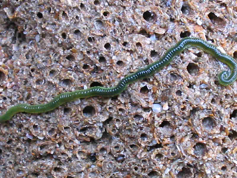
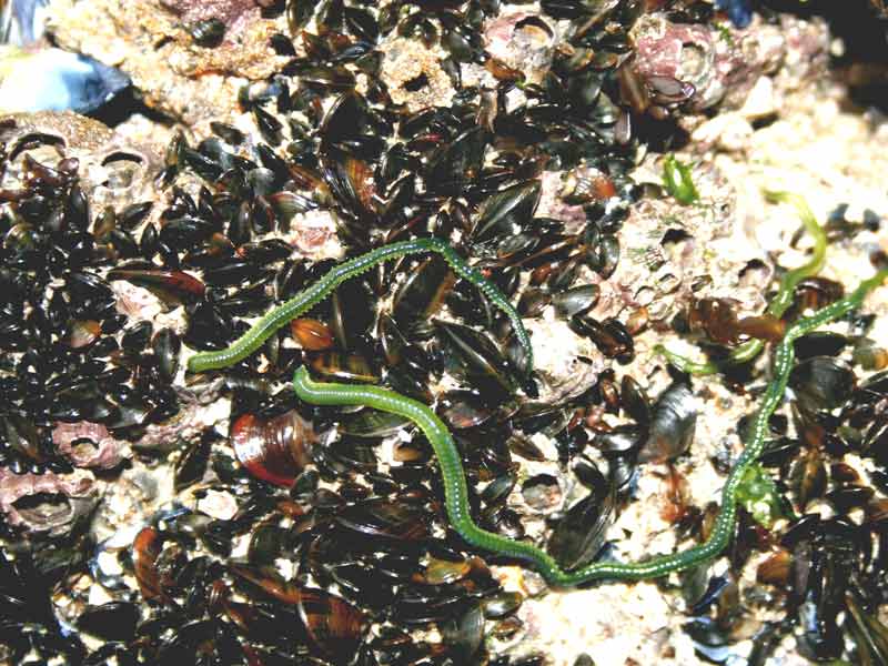
A long, thin, dorsally flattened worm, between 1 and 8.5 cm in length, composed of ca 116 segments. It is a conspicuous worm, light green in colour, but often a darker green in larger specimens. Dark brown spots may be present along the top and bottom of the parapodia. The head (the prostomium) is triangular (heart-shaped) and bears five antennae and two dark reddish-brown eyes. The median antenna is halfway between the eyes. The proboscis is long and club-shaped and covered by diffuse papillae that increase in size towards the open (distal) end. The opening is surrounded by a ring of larger papillae, usually 14 (but sometimes between 12 and 30). The tentacular cirri on segment one are short, spear-shaped and reach segments two to three. Dorsal tentacular cirri on segments two and three are longer and reach segment seven. The parapodial lobes (paddles) are rounded. The end of the worm (pygidium) bears two anal cirri that are 3-4 times as long as wide.
Recorded distribution in Britain and Ireland
Recorded around all British and Irish coasts but may have been misidentified (see additional information).
Global distribution
West coast of Sweden, Denmark, Germany, Norway, Faroe Islands, Iceland, and West Greenland to Disko Island in Baffin Bay (Bonse et al., 1996) (see additional information).
Habitat
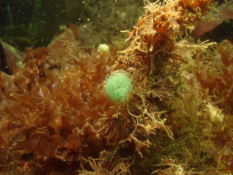
The green-leaf worm is found widely in crevices, barnacle and mussel beds and on kelp holdfasts from the intertidal to the shallow sublittoral. It may also be found subtidally on hard rocky bottoms and in shell gravel to depths of 150 m.
Depth range
0-150 mIdentifying features
- A long, dorsally flattened polychaete, between 1 and 8.5 cm in length, composed of ca 116 segments.
- Its colour varies from light yellowish green to bright green.
- The prostomium has two pairs of short antennae and a fifth, median antenna between the dark red eyes.
- Dorsal tentacular cirri on segments 2 and 3 are longer and reach segment 7.
- The ratio of the length to the thickness of the midbody dorsal cirri varies from 4.9 to 5.9.
- The maximum diameter of the papillae on the proboscis is 40 µm near the head (proximal) and 60 µm near the opening (distal end).
Additional information
Bonse et al. (1996) separated existing records of Eulalia viridis into two species based on morphological characteristics and isozyme polymorphism. They attributed the species name Eulalia viridis to northern specimens from the west coast of Sweden, Denmark, Germany, Norway, Faroe Islands, Iceland, and west Greenland to Disko Island in Baffin Bay. They attributed the species name Eulalia clavigera to specimens from France and the UK, although they suggested it was probably distributed in the Iberian Peninsula and Madeira and possibly the Mediterranean (Bosne et al., 1996). However, Bonse et al. (1996) only examined specimens from the North East of England (Newcastle upon Tyne) so it is uncertain if only one or both species occur in the UK, at present. The two species are difficult to distinguish without detailed examination under a microscope, therefore, existing records may confuse the species.
Listed by
- none -
Bibliography
Bonse, S., Schmidt, H., Eibye-Jabobsen, D. & Westheide, W., 1996. Eulalia viridis (Polychaeta: Phyllodocidae) is a complex of two species in northern Europe: Results from biochemical and morphological analyses. Cahiers de Biologie Marine, 37 (1), 33-48. DOI https://doi.org/10.21411/CBM.A.3348C329
De Kluijver, M.J., van Nieuwenhuijzen, A., Ingalsuo, S. & Veldhuijzen-Van Zanten, H., 2022. Macrobenthos of the North Sea - Polychaeta. Marine Species Identification Portal. ETI Bioinformatics. [cited 2022-06-09] Available from: http://species-identification.org/species.php?species_group=macrobenthos_polychaeta&menuentry=inleiding
Fish, J.D. & Fish, S., 1996. A student's guide to the seashore. Cambridge: Cambridge University Press.
Hayward, P., Nelson-Smith, T. & Shields, C. 1996. Collins pocket guide. Sea shore of Britain and northern Europe. London: HarperCollins.
Hayward, P.J. & Ryland, J.S. (ed.) 1995b. Handbook of the marine fauna of North-West Europe. Oxford: Oxford University Press.
Howson, C.M. & Picton, B.E., 1997. The species directory of the marine fauna and flora of the British Isles and surrounding seas. Belfast: Ulster Museum. [Ulster Museum publication, no. 276.]
JNCC (Joint Nature Conservation Committee), 1999. Marine Environment Resource Mapping And Information Database (MERMAID): Marine Nature Conservation Review Survey Database. [on-line] http://www.jncc.gov.uk/mermaid
Picton, B.E. & Costello, M.J., 1998. BioMar biotope viewer: a guide to marine habitats, fauna and flora of Britain and Ireland. [CD-ROM] Environmental Sciences Unit, Trinity College, Dublin.
Pleijel, F. & Dales, R.P., 1991. Polychaetes: British Phyllodocoideans, Typhloscolecoideans and Tomopteroideans. Oegstgeest, The Netherlands: U.B.S./Dr. W. Backhuys. [Synopsis of the British Fauna No. 45.]
Datasets
Centre for Environmental Data and Recording, 2018. Ulster Museum Marine Surveys of Northern Ireland Coastal Waters. Occurrence dataset https://www.nmni.com/CEDaR/CEDaR-Centre-for-Environmental-Data-and-Recording.aspx accessed via NBNAtlas.org on 2018-09-25.
Cofnod – North Wales Environmental Information Service, 2018. Miscellaneous records held on the Cofnod database. Occurrence dataset: https://doi.org/10.15468/hcgqsi accessed via GBIF.org on 2018-09-25.
Environmental Records Information Centre North East, 2018. ERIC NE Combined dataset to 2017. Occurrence dataset: http://www.ericnortheast.org.ukl accessed via NBNAtlas.org on 2018-09-38
Fife Nature Records Centre, 2018. St Andrews BioBlitz 2014. Occurrence dataset: https://doi.org/10.15468/erweal accessed via GBIF.org on 2018-09-27.
Fife Nature Records Centre, 2018. St Andrews BioBlitz 2015. Occurrence dataset: https://doi.org/10.15468/xtrbvy accessed via GBIF.org on 2018-09-27.
Kent Wildlife Trust, 2018. Biological survey of the intertidal chalk reefs between Folkestone Warren and Kingsdown, Kent 2009-2011. Occurrence dataset: https://www.kentwildlifetrust.org.uk/ accessed via NBNAtlas.org on 2018-10-01.
Kent Wildlife Trust, 2018. Kent Wildlife Trust Shoresearch Intertidal Survey 2004 onwards. Occurrence dataset: https://www.kentwildlifetrust.org.uk/ accessed via NBNAtlas.org on 2018-10-01.
National Trust, 2017. National Trust Species Records. Occurrence dataset: https://doi.org/10.15468/opc6g1 accessed via GBIF.org on 2018-10-01.
NBN (National Biodiversity Network) Atlas. Available from: https://www.nbnatlas.org.
North East Scotland Biological Records Centre, 2017. NE Scotland other invertebrate records 1800-2010. Occurrence dataset: https://doi.org/10.15468/ifjfxz accessed via GBIF.org on 2018-10-01.
OBIS (Ocean Biodiversity Information System), 2025. Global map of species distribution using gridded data. Available from: Ocean Biogeographic Information System. www.iobis.org. Accessed: 2025-08-08
South East Wales Biodiversity Records Centre, 2018. SEWBReC Worms (South East Wales). Occurrence dataset: https://doi.org/10.15468/5vh0w8 accessed via GBIF.org on 2018-10-02.
Yorkshire Wildlife Trust, 2018. Yorkshire Wildlife Trust Shoresearch. Occurrence dataset: https://doi.org/10.15468/1nw3ch accessed via GBIF.org on 2018-10-02.
Citation
This review can be cited as:
Last Updated: 29/04/2008


