Perforated barnacle (Perforatus perforatus)
Perforatus perforatus on rock with Mytilus edulis.
Photographer: Peter Barfield Copyright: Peter Barfield
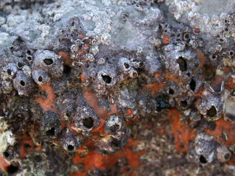
Perforatus perforatus and sponges on a boulder.
Photographer: Judith Oakley Copyright: Judith Oakley
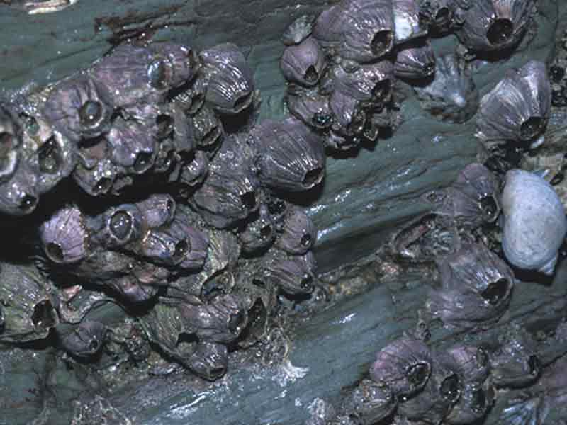
Perforatus perforatus, Whitsand Bay.
Photographer: Dr Keith Hiscock Copyright: Dr Keith Hiscock
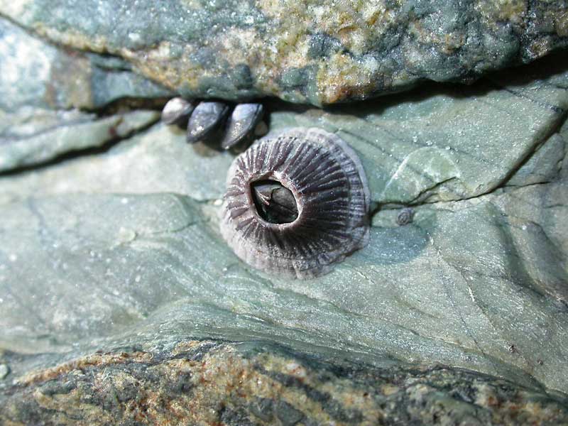
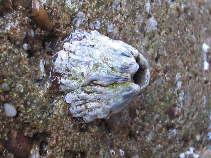
A single Perforatus perforatus specimen.
Photographer: Judith Oakley Copyright: Judith Oakley
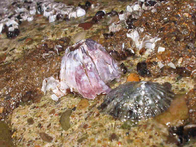
Dead, white Perforatus perforatus.
Photographer: Judith Oakley Copyright: Judith Oakley
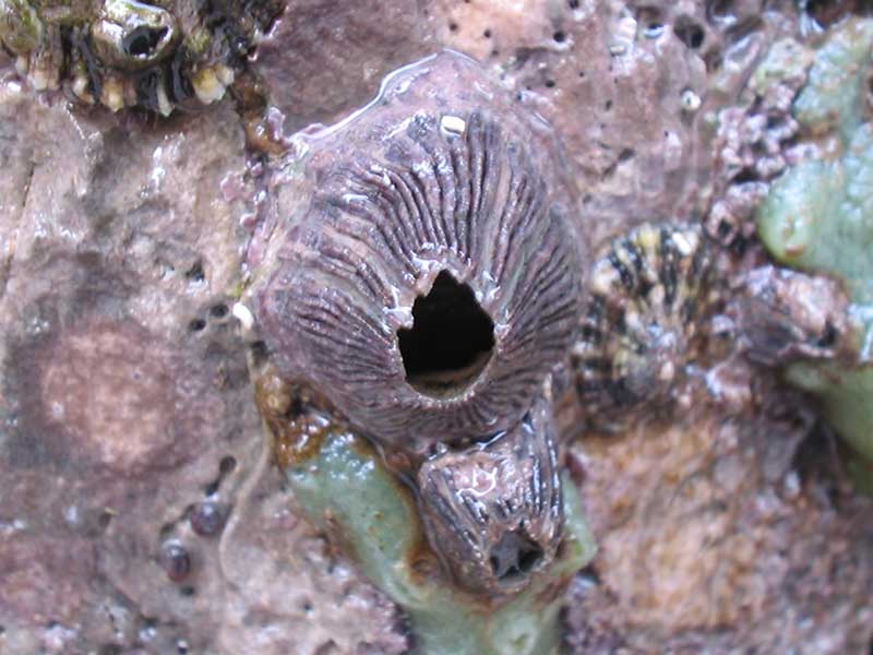
Larger Perforatus perforatus next to smaller Chthamalus montagui and white Semibalanus balanoides.
Photographer: Judith Oakley Copyright: Judith Oakley
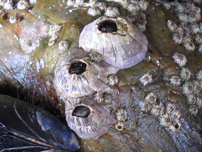
Pair of purple Perforatus perforatus on a rocky shore.
Photographer: Judith Oakley Copyright: Judith Oakley
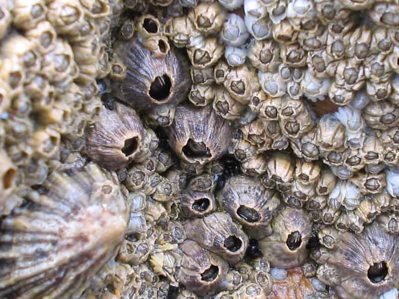
Three Perforatus perforatus individuals surrounded by much smaller Chthamalus montagui.
Photographer: Judith Oakley Copyright: Judith Oakley
Distribution data supplied by the Ocean Biodiversity Information System (OBIS). To interrogate UK data visit the NBN Atlas.Map Help
| Researched by | Marie Skewes | Refereed by | Admin |
| Authority | (Bruguière, 1789) | ||
| Other common names | - | Synonyms | Balanus perforatus |
Summary
Description
Up to 3 cm in diameter and 3 cm tall, Perforatus perforatus is recognised by its tapered, volcano-like shape. The shell wall consists of 6 purplish plates that are often vertically ridged, and sometimes separated at the apex leaving a jagged lip. Inside the operculum aperture, the tissue is marked with bright colours of pink, purple and blue. The tergoscutal flaps are brown to purple in colour, with blue and white spots.
Recorded distribution in Britain and Ireland
Perforatus perforatus is a southern species common in south-west England, especially Devon and Cornwall. It extends eastwards in the English Channel to East Sussex, is recorded in the Bristol Channel and South Wales, and reaches its northern limit in the southern Cardigan Bay. It has not yet reached Ireland or Scotland (Southward, 2008).Global distribution
Common in the Mediterranean and extending southward to the coasts of Africa and northwards up the Spanish and French coasts to the south-west coasts of Great Britain.Habitat
Perforatus perforatus is found from the mid-shore to the sublittoral on rocks and artificial structures and is sometimes common in wave exposed situations. Also present on ships' hulls.Depth range
-Identifying features
- Volcano-like shape.
- Small oval aperture.
- Operculum deeply immersed within the aperture.
- Terga with short, pointed beaks.
- Base calcareous.
Additional information
Aperture usually very small but quite large in sublittoral specimens.
Listed by
- none -
Bibliography
Bassindale, R., 1964. British Barnacles. London: The Linnean Society of London.[Synopses of the British Fauna, no. 14.]
Campbell, A.C., 1982. The Hamlyn guide to the flora and fauna of the Mediterranean Sea. London: Hamlyn.
Fish, J.D. & Fish, S., 1996. A student's guide to the seashore. Cambridge: Cambridge University Press.
Hayward, P., Nelson-Smith, T. & Shields, C. 1996. Collins pocket guide. Sea shore of Britain and northern Europe. London: HarperCollins.
Hayward, P.J. & Ryland, J.S. (ed.) 1995b. Handbook of the marine fauna of North-West Europe. Oxford: Oxford University Press.
Herbert, R.J.H., Hawkins, S.J., Sheader, M. & Southward, A.J., 2003. Range extension and reproduction of the barnacle Balanus perforatus in the eastern English Channel. Journal of the Marine Biological Association of the United Kingdom, 83 (1), 73-82. DOI 10.1017/S0025315403006829h
Hiscock, K., Southward, A., Tittley, I., Jory, A. & Hawkins, S., 2001. The impact of climate change on subtidal and intertidal benthic species in Scotland. Scottish National Heritage Research, Survey and Monitoring Report , no. 182., Edinburgh: Scottish National Heritage
Howson, C.M. & Picton, B.E., 1997. The species directory of the marine fauna and flora of the British Isles and surrounding seas. Belfast: Ulster Museum. [Ulster Museum publication, no. 276.]
Southward, A.J., 2008. Barnacles. Synopses of the British Fauna, (New Series) (ed. J.H. Crothers & P.J. Hayward), No. 57.Shrewsbury, Field Studies Council
Datasets
Fenwick, 2018. Aphotomarine. Occurrence dataset http://www.aphotomarine.com/index.html Accessed via NBNAtlas.org on 2018-10-01
Fife Nature Records Centre, 2018. St Andrews BioBlitz 2014. Occurrence dataset: https://doi.org/10.15468/erweal accessed via GBIF.org on 2018-09-27.
Fife Nature Records Centre, 2018. St Andrews BioBlitz 2015. Occurrence dataset: https://doi.org/10.15468/xtrbvy accessed via GBIF.org on 2018-09-27.
Kent Wildlife Trust, 2018. Kent Wildlife Trust Shoresearch Intertidal Survey 2004 onwards. Occurrence dataset: https://www.kentwildlifetrust.org.uk/ accessed via NBNAtlas.org on 2018-10-01.
National Trust, 2017. National Trust Species Records. Occurrence dataset: https://doi.org/10.15468/opc6g1 accessed via GBIF.org on 2018-10-01.
NBN (National Biodiversity Network) Atlas. Available from: https://www.nbnatlas.org.
OBIS (Ocean Biodiversity Information System), 2025. Global map of species distribution using gridded data. Available from: Ocean Biogeographic Information System. www.iobis.org. Accessed: 2025-08-08
South East Wales Biodiversity Records Centre, 2018. SEWBReC Myriapods, Isopods, and allied species (South East Wales). Occurrence dataset: https://doi.org/10.15468/rvxsqs accessed via GBIF.org on 2018-10-02.
South East Wales Biodiversity Records Centre, 2018. Dr Mary Gillham Archive Project. Occurance dataset: http://www.sewbrec.org.uk/ accessed via NBNAtlas.org on 2018-10-02
Citation
This review can be cited as:
Last Updated: 08/05/2008
