Parchment worm (Chaetopterus variopedatus)
Distribution data supplied by the Ocean Biodiversity Information System (OBIS). To interrogate UK data visit the NBN Atlas.Map Help
| Researched by | Penny Avant | Refereed by | Admin |
| Authority | (Renier, 1804) | ||
| Other common names | - | Synonyms | - |
Summary
Description
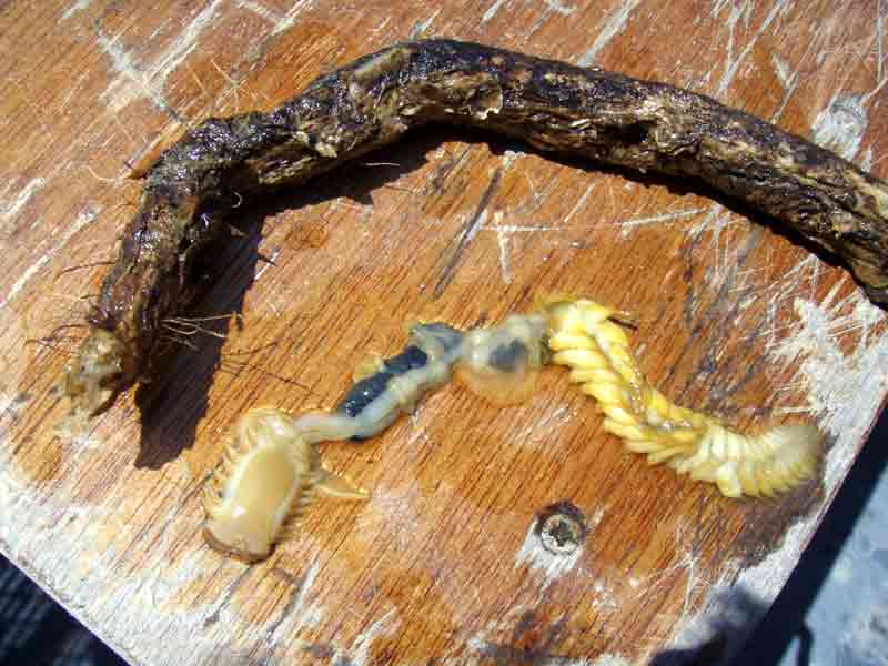
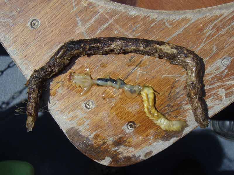
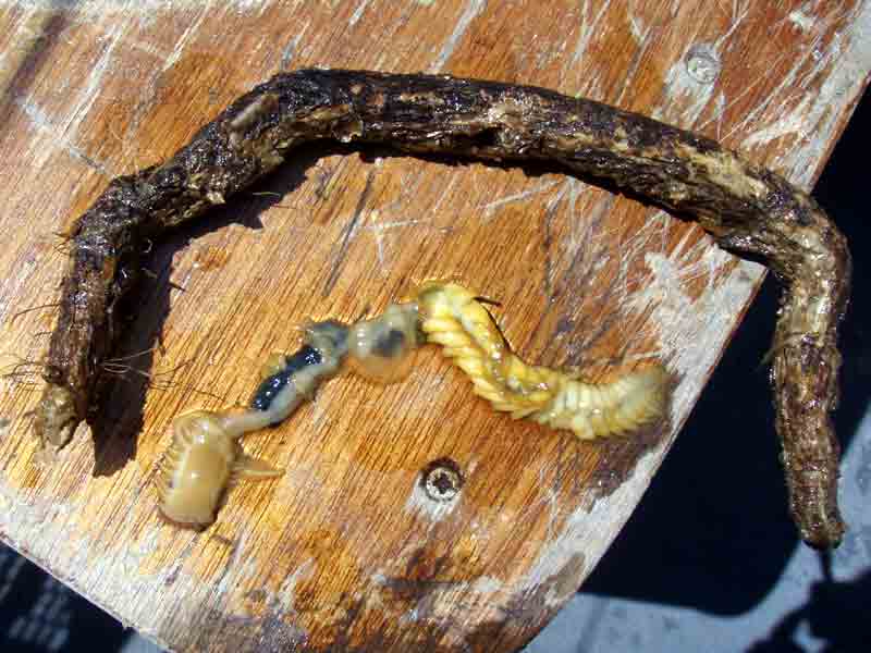
The parchment worm Chaetopterus variopedatus is distinctive, large and stout but fragile. It grows up to 25 cm in length and between 1 and 2.5 cm in width. It is yellowish or greenish white in colour with mature females becoming pinkish. The body is divided into three distinct regions, the short anterior end with an inconspicuous head, a mid region with highly specialized feeding structures, and a longer, regularly segmented hind end with repeating appendages. The worms live permanently in tough, flexible tubes of a whitish parchment-like material. The open end is narrow and protrudes slightly from the substratum.
Recorded distribution in Britain and Ireland
Widely distributed around British coasts, but not recorded on the east coast of England south of the Tees estuary.Global distribution
Cosmopolitan.Habitat
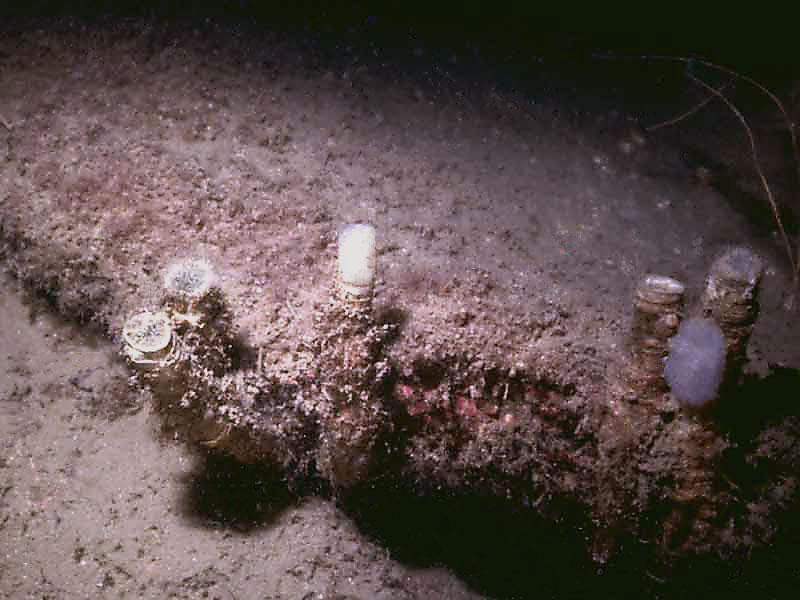
The tough permanent tubes are seen in sand and stone or shell gravel from low water to considerable depths, and in deeper water on rock, in fissures in rock and under boulders.Depth range
-Identifying features
- An irregularly segmented worm, up to 25 cm long and 1 to 2.5 cm wide, living permanently in a parchment-like tube.
- Body in three distinct regions, a short anterior region, mid region with differing appendages modified for feeding, longer posterior region distinctly segmented.
- Parts of the body phosphorescent.
- The tubes protrude slightly from the sand at both ends and are non-ringed, tough and flexible.
Additional information
Other species of polychaete may occasionally occupy vacant tubes.
Listed by
- none -
Bibliography
Bruce, J.R., Colman, J.S. & Jones, N.S., 1963. Marine fauna of the Isle of Man. Liverpool: Liverpool University Press.
Fish, J.D. & Fish, S., 1996. A student's guide to the seashore. Cambridge: Cambridge University Press.
Foster-Smith, J. (ed.), 2000. The marine fauna and flora of the Cullercoats District. Marine species records for the North East Coast of England. Sunderland: Penshaw Press, for the Dove Marine Laboratory, University of Newcastle upon Tyne.
Hauton, C., Hall-Spencer, J.M. & Moore, P.G., 2003. An experimental study of the ecological impacts of hydraulic bivalve dredging on maerl. ICES Journal of Marine Science, 60, 381-392.
Hayward, P., Nelson-Smith, T. & Shields, C. 1996. Collins pocket guide. Sea shore of Britain and northern Europe. London: HarperCollins.
Hayward, P.J. & Ryland, J.S. (ed.) 1995b. Handbook of the marine fauna of North-West Europe. Oxford: Oxford University Press.
Howson, C.M. & Picton, B.E., 1997. The species directory of the marine fauna and flora of the British Isles and surrounding seas. Belfast: Ulster Museum. [Ulster Museum publication, no. 276.]
JNCC (Joint Nature Conservation Committee), 1999. Marine Environment Resource Mapping And Information Database (MERMAID): Marine Nature Conservation Review Survey Database. [on-line] http://www.jncc.gov.uk/mermaid
Picton, B.E. & Costello, M.J., 1998. BioMar biotope viewer: a guide to marine habitats, fauna and flora of Britain and Ireland. [CD-ROM] Environmental Sciences Unit, Trinity College, Dublin.
Datasets
Centre for Environmental Data and Recording, 2018. Ulster Museum Marine Surveys of Northern Ireland Coastal Waters. Occurrence dataset https://www.nmni.com/CEDaR/CEDaR-Centre-for-Environmental-Data-and-Recording.aspx accessed via NBNAtlas.org on 2018-09-25.
Fenwick, 2018. Aphotomarine. Occurrence dataset http://www.aphotomarine.com/index.html Accessed via NBNAtlas.org on 2018-10-01
Manx Biological Recording Partnership, 2022. Isle of Man historical wildlife records 1990 to 1994. Occurrence dataset:https://doi.org/10.15468/aru16v accessed via GBIF.org on 2024-09-27.
NBN (National Biodiversity Network) Atlas. Available from: https://www.nbnatlas.org.
OBIS (Ocean Biodiversity Information System), 2025. Global map of species distribution using gridded data. Available from: Ocean Biogeographic Information System. www.iobis.org. Accessed: 2025-07-31
Citation
This review can be cited as:
Last Updated: 21/06/2002


