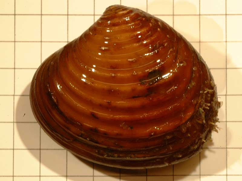
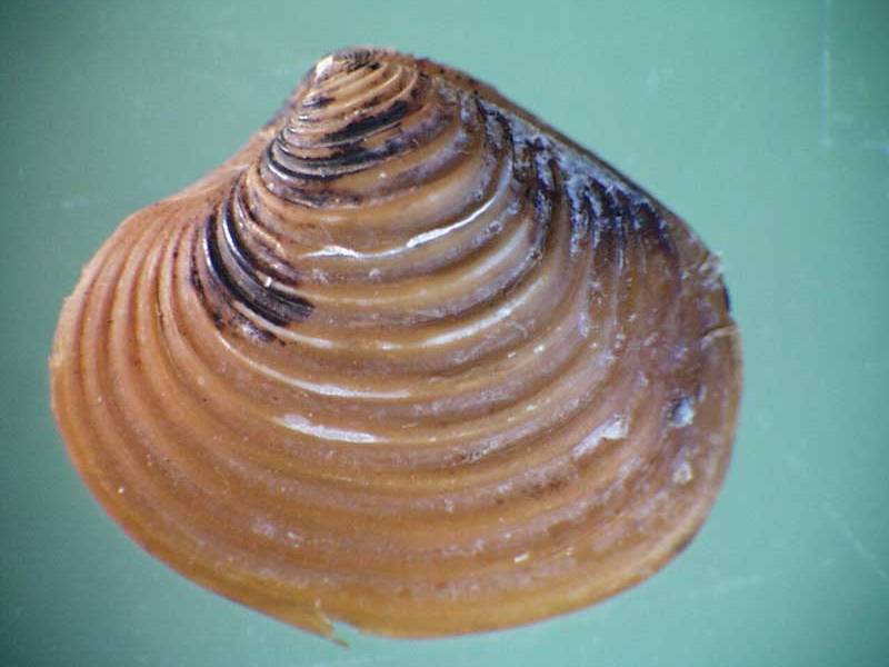
Furrowed astarte (Astarte sulcata)
Distribution data supplied by the Ocean Biodiversity Information System (OBIS). To interrogate UK data visit the NBN Atlas.Map Help
| Researched by | Susie Ballerstedt | Refereed by | Admin |
| Authority | (da Costa, 1778) | ||
| Other common names | - | Synonyms | - |
Summary
Description
Astarte sulcata has a thick, broadly oval, equivalve shell up to 3 cm long. It is white or pink with a thick, mid to dark brown periostracum, and is often encrusted and stained black around its prominent umbones. The shell has about 20 bold concentric ridges. There is a distinct and deep heart-shaped depression dorsally anterior to the beak (lunule) and a deep elongate depression dorsally posterior to the beak (escutcheon), both are split longitudinally by the hinge line. The adductor scars and pallial line are clear. The inner shell margin is crenulate.
Recorded distribution in Britain and Ireland
Recorded at sites in Shetland and Orkney, the Northumberland coast south to Druridge Bay; the Llyn Peninsula and the Irish Sea, south Isle of Man and the west coast of Scotland. Also recorded from Torr Head to Carlingford Lough in Ireland.Global distribution
Found from southern Norway, south to north west Africa and the Mediterranean.Habitat
Found sublittorally in muddy sands to gravels from 5 m to considerable depths.Depth range
-Identifying features
- Shell broadly oval.
- White or pink shell with thick, brown periostracum.
- Up to 3 cm long.
- Distinct and deep heart-shaped depression dorsally anterior to the beak (lunule).
- Distinct and deep elongate depression dorsally posterior to the beak (escutcheon).
- Left valve has 2 prominent cardinal teeth below the umbone.
- Right valve bears a thick anterior cardinal tooth and a posteriorly slender tooth.
- Approximately 20 bold, concentric ridges on valves.
- Inner margin of shell crenulate.
Additional information
No text entered
Listed by
- none -
Bibliography
Bruce, J.R., Colman, J.S. & Jones, N.S., 1963. Marine fauna of the Isle of Man. Liverpool: Liverpool University Press.
Foster-Smith, J. (ed.), 2000. The marine fauna and flora of the Cullercoats District. Marine species records for the North East Coast of England. Sunderland: Penshaw Press, for the Dove Marine Laboratory, University of Newcastle upon Tyne.
Hayward, P., Nelson-Smith, T. & Shields, C. 1996. Collins pocket guide. Sea shore of Britain and northern Europe. London: HarperCollins.
Hayward, P.J. & Ryland, J.S. (ed.) 1995b. Handbook of the marine fauna of North-West Europe. Oxford: Oxford University Press.
Howson, C.M. & Picton, B.E., 1997. The species directory of the marine fauna and flora of the British Isles and surrounding seas. Belfast: Ulster Museum. [Ulster Museum publication, no. 276.]
JNCC (Joint Nature Conservation Committee), 1999. Marine Environment Resource Mapping And Information Database (MERMAID): Marine Nature Conservation Review Survey Database. [on-line] http://www.jncc.gov.uk/mermaid
Mackie, A.S.Y., Oliver, P.G. & Rees, E.I.S., 1995. Benthic biodiversity in the southern Irish Sea. Studies in Marine Biodiversity and Systematics from the National Museum of Wales. BIOMOR Reports, no. 1.
Saleuddin, A.S.M., 1964. The gonads and reproductive cycle of Astarte sulcata (Da Costa) and sexuality of A. elliptica (Brown). Proceedings of the Malacological Society of London, 36, 141-148.
Seaward, D.R., 1982. Sea area atlas of the marine molluscs of Britain and Ireland. Peterborough: Nature Conservancy Council.
Seaward, D.R., 1990. Distribution of marine molluscs of north west Europe. Peterborough: Nature Conservancy Council.
Tebble, N., 1976. British Bivalve Seashells. A Handbook for Identification, 2nd ed. Edinburgh: British Museum (Natural History), Her Majesty's Stationary Office.
Datasets
Bristol Regional Environmental Records Centre, 2017. BRERC species records recorded over 15 years ago. Occurrence dataset: https://doi.org/10.15468/h1ln5p accessed via GBIF.org on 2018-09-25.
Centre for Environmental Data and Recording, 2018. Ulster Museum Marine Surveys of Northern Ireland Coastal Waters. Occurrence dataset https://www.nmni.com/CEDaR/CEDaR-Centre-for-Environmental-Data-and-Recording.aspx accessed via NBNAtlas.org on 2018-09-25.
Conchological Society of Great Britain & Ireland, 2018. Mollusc (marine) data for Great Britain and Ireland - restricted access. Occurrence dataset: https://doi.org/10.15468/4bsawx accessed via GBIF.org on 2018-09-25.
Conchological Society of Great Britain & Ireland, 2023. Mollusc (marine) records for Great Britain and Ireland. Occurrence dataset: https://doi.org/10.15468/aurwcz accessed via GBIF.org on 2024-09-27.
Merseyside BioBank., 2018. Merseyside BioBank (unverified). Occurrence dataset: https://doi.org/10.15468/iou2ld accessed via GBIF.org on 2018-10-01.
NBN (National Biodiversity Network) Atlas. Available from: https://www.nbnatlas.org.
OBIS (Ocean Biodiversity Information System), 2025. Global map of species distribution using gridded data. Available from: Ocean Biogeographic Information System. www.iobis.org. Accessed: 2025-08-08
Citation
This review can be cited as:
Last Updated: 17/04/2008


