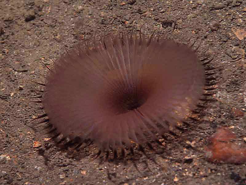
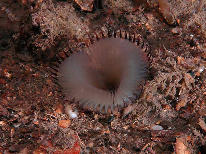
A fanworm (Myxicola infundibulum)
Distribution data supplied by the Ocean Biodiversity Information System (OBIS). To interrogate UK data visit the NBN Atlas.Map Help
| Researched by | Penny Avant | Refereed by | Admin |
| Authority | (Montagu, 1808) | ||
| Other common names | - | Synonyms | - |
Summary
Description
Recorded distribution in Britain and Ireland
Widely distributed, but often locally scarce, around British and Irish coasts.Global distribution
-Habitat
Found buried in mud or sand sublittorally of depth down to 30 m in conditions of varied wave and tide exposure. Most abundant in wave sheltered habitats and may occur in variable salinityDepth range
-Identifying features
- A stout, segmented worm, up to 20 cm in length that lives permanently in a tube.
- The head is two-lobed and surrounded by a wide funnel of tentacles that are joined for nearly all their length, with only their tips free.
- The body is orange or dark yellow in colour and the tentacles are purple or brown.
- The thick tube is transparent and mucilaginous, and remains almost completely buried in the sediment.
Additional information
Myxicola infundibulum may occasionally be found in conditions of variable salinity such as inlets and harbours.Listed by
- none -
Bibliography
Fish, J.D. & Fish, S., 1996. A student's guide to the seashore. Cambridge: Cambridge University Press.
Hayward, P., Nelson-Smith, T. & Shields, C. 1996. Collins pocket guide. Sea shore of Britain and northern Europe. London: HarperCollins.
Hayward, P.J. & Ryland, J.S. (ed.) 1995b. Handbook of the marine fauna of North-West Europe. Oxford: Oxford University Press.
Howson, C.M. & Picton, B.E., 1997. The species directory of the marine fauna and flora of the British Isles and surrounding seas. Belfast: Ulster Museum. [Ulster Museum publication, no. 276.]
JNCC (Joint Nature Conservation Committee), 1999. Marine Environment Resource Mapping And Information Database (MERMAID): Marine Nature Conservation Review Survey Database. [on-line] http://www.jncc.gov.uk/mermaid
Datasets
Centre for Environmental Data and Recording, 2018. Ulster Museum Marine Surveys of Northern Ireland Coastal Waters. Occurrence dataset https://www.nmni.com/CEDaR/CEDaR-Centre-for-Environmental-Data-and-Recording.aspx accessed via NBNAtlas.org on 2018-09-25.
Manx Biological Recording Partnership, 2022. Isle of Man historical wildlife records 1990 to 1994. Occurrence dataset:https://doi.org/10.15468/aru16v accessed via GBIF.org on 2024-09-27.
NBN (National Biodiversity Network) Atlas. Available from: https://www.nbnatlas.org.
OBIS (Ocean Biodiversity Information System), 2025. Global map of species distribution using gridded data. Available from: Ocean Biogeographic Information System. www.iobis.org. Accessed: 2025-08-01
Citation
This review can be cited as:
Last Updated: 28/11/2006


