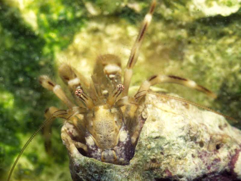
A hermit crab (Cestopagurus timidus)
Distribution data supplied by the Ocean Biodiversity Information System (OBIS). To interrogate UK data visit the NBN Atlas.Map Help
| Researched by | Anna Neish | Refereed by | Admin |
| Authority | (Roux, 1830) | ||
| Other common names | - | Synonyms | Catapaguroides timidus (Roux, 1830) |
Summary
Description
Recorded distribution in Britain and Ireland
Recorded in the south west of England around the Isles of Scilly and in other isolated locations including the Clyde region, Scotland and Northern Ireland (see Ingle, 1993).
Global distribution
Found in the Gulf of St. Malo south to the Canary Islands and common throughout the Mediterranean.
Habitat
Cestopagurus timidus is associated with soft substrata, especially among seagrasses and algae, in the intertidal and shallow sublittoral to 80 m.
Depth range
-Identifying features
- Carapace length about 5 mm.
- Rostrum small, acute, and slightly protruding.
- Right claw (chela) more robust than left.
- Claw (chelae) surfaces have long setae.
- Eyes extend beyond antennal peduncles.
- In females the first pleopods are lacking.
Additional information
No text enteredListed by
Bibliography
Campbell, A.C., 1982. The Hamlyn guide to the flora and fauna of the Mediterranean Sea. London: Hamlyn.
Hayward, P., Nelson-Smith, T. & Shields, C. 1996. Collins pocket guide. Sea shore of Britain and northern Europe. London: HarperCollins.
Hayward, P.J. & Ryland, J.S. (ed.) 1995b. Handbook of the marine fauna of North-West Europe. Oxford: Oxford University Press.
Howson, C.M. & Picton, B.E., 1997. The species directory of the marine fauna and flora of the British Isles and surrounding seas. Belfast: Ulster Museum. [Ulster Museum publication, no. 276.]
Ingle, R., 1993. Hermit crabs of the northeastern Atlantic Ocean and the Mediterranean Sea. An illustrated key. London: Natural History Museum Publications, Chapman & Hall.
Picton, B.E. & Costello, M.J., 1998. BioMar biotope viewer: a guide to marine habitats, fauna and flora of Britain and Ireland. [CD-ROM] Environmental Sciences Unit, Trinity College, Dublin.
Datasets
NBN (National Biodiversity Network) Atlas. Available from: https://www.nbnatlas.org.
OBIS (Ocean Biodiversity Information System), 2025. Global map of species distribution using gridded data. Available from: Ocean Biogeographic Information System. www.iobis.org. Accessed: 2025-08-08
Citation
This review can be cited as:
Last Updated: 04/07/2005


