Queen scallop (Aequipecten opercularis)
Distribution data supplied by the Ocean Biodiversity Information System (OBIS). To interrogate UK data visit the NBN Atlas.Map Help
| Researched by | Michelle Carter | Refereed by | Admin |
| Authority | (Linnaeus, 1758) | ||
| Other common names | - | Synonyms | Chlamys opercularis (Linnaeus, 1758) |
Summary
Description
Recorded distribution in Britain and Ireland
Found around all British and Irish coasts.Global distribution
Found south of Norway to the Mediterranean and the Canary Isles.Habitat
The queen scallop is found between tidemarks, to depths of 100 m and on sand or gravel, often in high densities. It also occurs amongst beds of horse mussels Modiolus modiolus.Depth range
-Identifying features
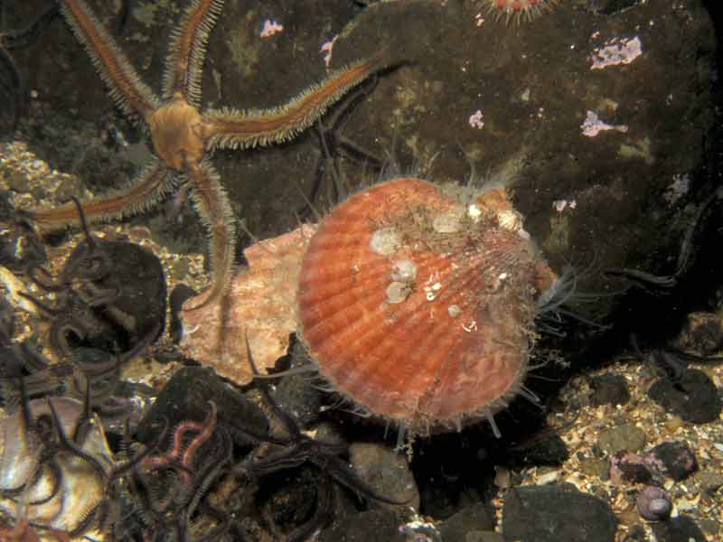
- Shell variable in colour from pink, brown, orange or yellow with bands, zigzags, rays and spots.
- Each valve has about 20 radiating ridges.
- Grows up to 9 cm in diameter.
- The anterior ear of the right valve is slightly larger than the left.
Additional information
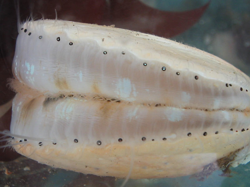
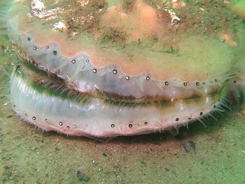
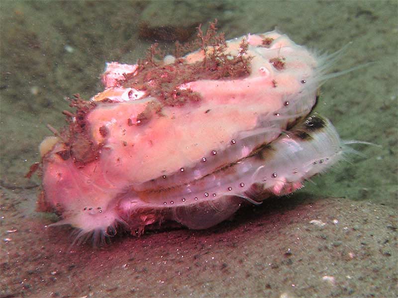
Young scallops remain attached by the byssus, later becoming unattached and are then able to swim freely. The queen scallop differs from the king scallop Pecten maximus. In the king scallop, the lower valve on which it lies, is deeply convex and white, while the upper valve, generally red or brown (often marbled) is almost flat. In the queen scallop, both valves are convex, the upper being slightly more-so than the right and colour is variable. The number of ribs varies between species with the queen scallop possessing 19 to 22 ribs and the king scallop 15 to 17 ribs. The queen scallop is fished commercially at a number of localities and particularly around the Isle of Man. Often the valves are heavily encrusted with various organisms particularly sponges. This relationship has been described as protective-mutualism. The sponge is thought to protect the scallop from predation by starfishes while the sponges are protected from predation by the sea slug, Archidoris pseudoargus. Scallops detach from their byssal thread at some point in their life, usually upon attaining 1.5-2.0 cm but retains the ability to secrete a byssus until at least 6.5 cm long.Listed by
- none -
Bibliography
Christensen, J.M., 1980. Seashells. Bivalves of the British and Northern European Seas. Revised and adapted by Peter S. Dance. Hamondsworth: Penguin Books Ltd.
Fish, J.D. & Fish, S., 1996. A student's guide to the seashore. Cambridge: Cambridge University Press.
Hayward, P.J. & Ryland, J.S. (ed.) 1995b. Handbook of the marine fauna of North-West Europe. Oxford: Oxford University Press.
Howson, C.M. & Picton, B.E., 1997. The species directory of the marine fauna and flora of the British Isles and surrounding seas. Belfast: Ulster Museum. [Ulster Museum publication, no. 276.]
Seaward, D.R., 1982. Sea area atlas of the marine molluscs of Britain and Ireland. Peterborough: Nature Conservancy Council.
Tebble, N., 1966. British Bivalve Seashells. A Handbook for Identification. Edinburgh: British Museum (Natural History), Her Majesty's Stationary Office.
Datasets
Centre for Environmental Data and Recording, 2018. IBIS Project Data. Occurrence dataset: https://www.nmni.com/CEDaR/CEDaR-Centre-for-Environmental-Data-and-Recording.aspx accessed via NBNAtlas.org on 2018-09-25.
Centre for Environmental Data and Recording, 2018. Ulster Museum Marine Surveys of Northern Ireland Coastal Waters. Occurrence dataset https://www.nmni.com/CEDaR/CEDaR-Centre-for-Environmental-Data-and-Recording.aspx accessed via NBNAtlas.org on 2018-09-25.
Cofnod – North Wales Environmental Information Service, 2018. Miscellaneous records held on the Cofnod database. Occurrence dataset: https://doi.org/10.15468/hcgqsi accessed via GBIF.org on 2018-09-25.
Conchological Society of Great Britain & Ireland, 2018. Mollusc (marine) data for Great Britain and Ireland - restricted access. Occurrence dataset: https://doi.org/10.15468/4bsawx accessed via GBIF.org on 2018-09-25.
Conchological Society of Great Britain & Ireland, 2023. Mollusc (marine) records for Great Britain and Ireland. Occurrence dataset: https://doi.org/10.15468/aurwcz accessed via GBIF.org on 2024-09-27.
Environmental Records Information Centre North East, 2018. ERIC NE Combined dataset to 2017. Occurrence dataset: http://www.ericnortheast.org.ukl accessed via NBNAtlas.org on 2018-09-38
Fenwick, 2018. Aphotomarine. Occurrence dataset http://www.aphotomarine.com/index.html Accessed via NBNAtlas.org on 2018-10-01
Kent Wildlife Trust, 2018. Kent Wildlife Trust Shoresearch Intertidal Survey 2004 onwards. Occurrence dataset: https://www.kentwildlifetrust.org.uk/ accessed via NBNAtlas.org on 2018-10-01.
Manx Biological Recording Partnership, 2022. Isle of Man historical wildlife records 1990 to 1994. Occurrence dataset:https://doi.org/10.15468/aru16v accessed via GBIF.org on 2024-09-27.
Merseyside BioBank., 2018. Merseyside BioBank (unverified). Occurrence dataset: https://doi.org/10.15468/iou2ld accessed via GBIF.org on 2018-10-01.
National Trust, 2017. National Trust Species Records. Occurrence dataset: https://doi.org/10.15468/opc6g1 accessed via GBIF.org on 2018-10-01.
NBN (National Biodiversity Network) Atlas. Available from: https://www.nbnatlas.org.
OBIS (Ocean Biodiversity Information System), 2025. Global map of species distribution using gridded data. Available from: Ocean Biogeographic Information System. www.iobis.org. Accessed: 2025-08-08
Outer Hebrides Biological Recording, 2018. Invertebrates (except insects), Outer Hebrides. Occurrence dataset: https://doi.org/10.15468/hpavud accessed via GBIF.org on 2018-10-01.
South East Wales Biodiversity Records Centre, 2018. SEWBReC Molluscs (South East Wales). Occurrence dataset: https://doi.org/10.15468/jos5ga accessed via GBIF.org on 2018-10-02.
Citation
This review can be cited as:
Last Updated: 29/05/2008


