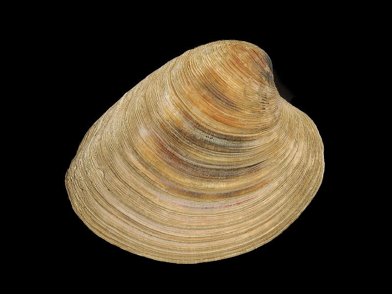
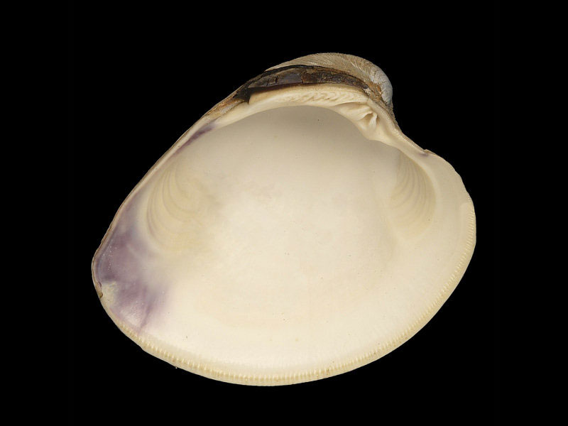
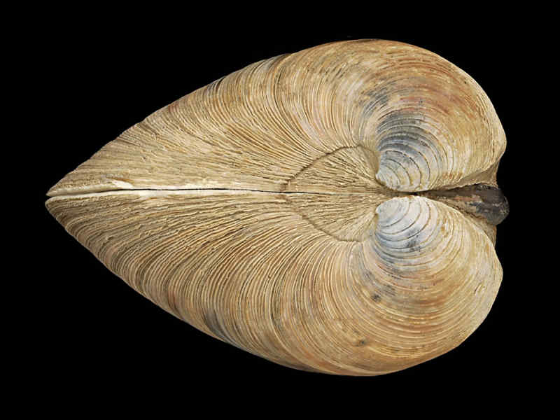
Hard-shell clam (Mercenaria mercenaria)
Distribution data supplied by the Ocean Biodiversity Information System (OBIS). To interrogate UK data visit the NBN Atlas.Map Help
| Researched by | Michelle Carter | Refereed by | Admin |
| Authority | (Linnaeus, 1758) | ||
| Other common names | - | Synonyms | - |
Summary
Description
Recorded distribution in Britain and Ireland
This species has a limited distribution in British waters with isolated records from Burnham-on Crouch, the south coast of England, Pembrokeshire and Loch Sunart, Scotland. There are no records in Ireland.Global distribution
This species is native to north America and is found around the Gulf coasts from the Gulf of St. Lawrence to Texas. High abundances have been recorded from Massachusetts to Virginia. Introduced populations are found in Europe and California.Habitat
Found buried in muddy sediment on the lower shore and shallow sublittoral and in bays and estuaries. Prefers sandy environments to depths of 15 m.Depth range
-Identifying features
- The shell has a sculpture of concentric grooves and striations.
- The shell is light brown to grey in colour forming fine bands.
- The inner shell surface is shiny with a purplish-blue tinge around the muscle scars.
- Grows up to 12 cm in length.
- Each valve has three conspicuous teeth.
- Jointed siphons with a fringe of tentacles on the inhalent siphon.
- A large foot that is white in colour.
Additional information
Commonly known as the Quahog and used to make clam juice. This is a non-native species unsuccessfully introduced into British waters several times since the middle of the nineteenth century. The first live specimen was found in 1864 in the Humber. Merceneria mercenaria was successfully introduced from the USA into Southampton Water in 1925. Due to the colouration of the shell, the native American Indians utilised the shell as 'wampun' for use as currency, hence its scientific name.Listed by
- none -
Bibliography
Eno, N.C., Clark, R.A. & Sanderson, W.G. (ed.) 1997. Non-native marine species in British waters: a review and directory. Peterborough: Joint Nature Conservation Committee.
Gibson, R., Hextall, B. & Rogers, A., 2001. Photographic guide to the sea and seashore life of Britain and north-west Europe. Oxford: Oxford University Press.
Hayward, P.J. & Ryland, J.S. (ed.) 1995b. Handbook of the marine fauna of North-West Europe. Oxford: Oxford University Press.
Howson, C.M. & Picton, B.E. ed., 1999. The species directory of the marine fauna and flora of the British Isles and surrounding seas. CD-ROM Edition. Ulster Museum and The Marine Conservation Society, Belfast and Ross-on-Wye., Belfast: Ulster Museum. [Ulster Museum publication no. 280.]
Seaward, D.R., 1982. Sea area atlas of the marine molluscs of Britain and Ireland. Peterborough: Nature Conservancy Council.
Stanley, J.G. & Dewitt, R., 1983. Species profiles: Life histories and environmental requirements of coastal fishes and invertebrates (North Atlantic)-hard clam. U.S. Fish and Wildlife Services. FWS/OBS-82/11.18. U.S. Army Corps of Engineers, TR EL-82-4. 19pp.
Tebble, N., 1966. British Bivalve Seashells. A Handbook for Identification. Edinburgh: British Museum (Natural History), Her Majesty's Stationary Office.
Datasets
Conchological Society of Great Britain & Ireland, 2018. Mollusc (marine) data for Great Britain and Ireland - restricted access. Occurrence dataset: https://doi.org/10.15468/4bsawx accessed via GBIF.org on 2018-09-25.
Conchological Society of Great Britain & Ireland, 2023. Mollusc (marine) records for Great Britain and Ireland. Occurrence dataset: https://doi.org/10.15468/aurwcz accessed via GBIF.org on 2024-09-27.
Merseyside BioBank., 2018. Merseyside BioBank (unverified). Occurrence dataset: https://doi.org/10.15468/iou2ld accessed via GBIF.org on 2018-10-01.
National Trust, 2017. National Trust Species Records. Occurrence dataset: https://doi.org/10.15468/opc6g1 accessed via GBIF.org on 2018-10-01.
NBN (National Biodiversity Network) Atlas. Available from: https://www.nbnatlas.org.
OBIS (Ocean Biodiversity Information System), 2025. Global map of species distribution using gridded data. Available from: Ocean Biogeographic Information System. www.iobis.org. Accessed: 2025-08-08
Citation
This review can be cited as:
Last Updated: 17/10/2005


