Sole (Solea solea)
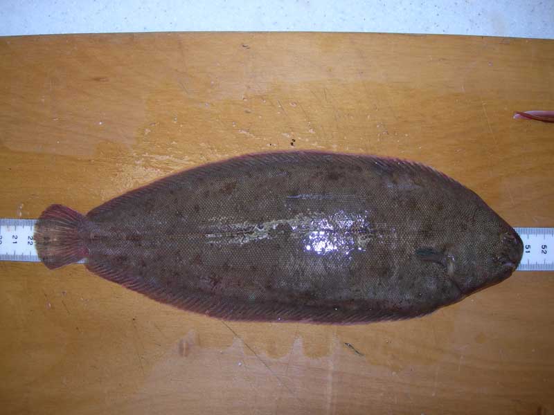
Freshly caught specimen of Solea solea.
Photographer: Andrew Marriott Copyright: Andrew Marriott
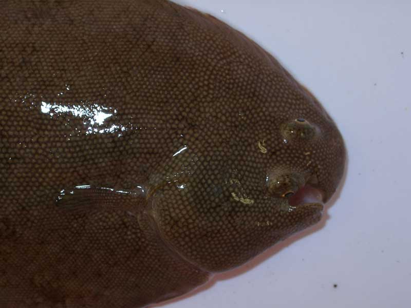
Dorsal view of head of Solea solea.
Photographer: Hilmar Hinz Copyright: Dr Hilmar Hinz
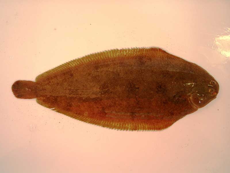
Dorsal view of whole Solea solea.
Photographer: Hilmar Hinz Copyright: Dr Hilmar Hinz
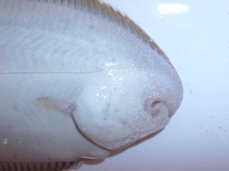
Ventral view of head of Solea solea.
Photographer: Hilmar Hinz Copyright: Dr Hilmar Hinz
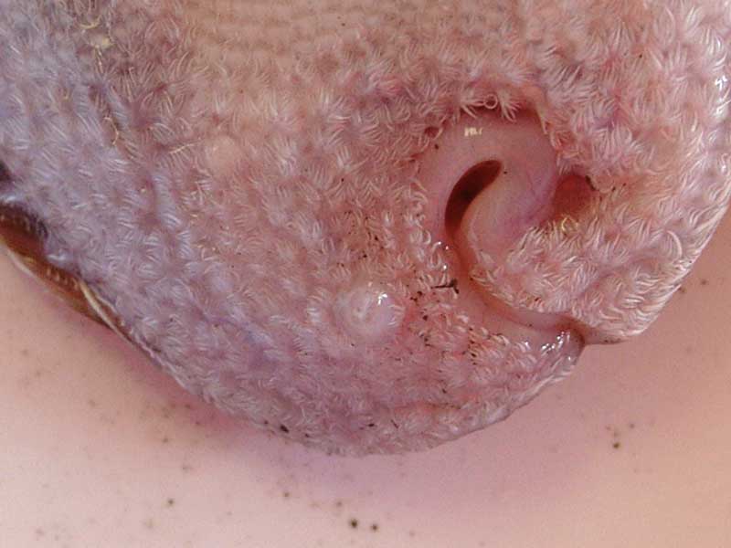
Ventral view of mouth of Solea solea.
Photographer: Hilmar Hinz Copyright: Dr Hilmar Hinz
Distribution data supplied by the Ocean Biodiversity Information System (OBIS). To interrogate UK data visit the NBN Atlas.Map Help
| Researched by | Al Reeve | Refereed by | Admin |
| Authority | (Linnaeus, 1758) | ||
| Other common names | Dover sole, common sole, black sole | Synonyms | Solea vulgaris (Linnaeus, 1758) |
Summary
Description
Solea solea is a strongly compressed flatfish with eyes and snout on the right hand side. It is oval in shape with a rounded head and can grow up to 70 cm in length but is more commonly between 30-40 cm. Depending on the substratum the colour of the sole can vary between grey, reddish brown and grey-brown with dark blotches. The sole has two well developed pectoral fins, and the dorsal and anal fins connect to the base of the tail. The anal and dorsal fins have a narrow white margin and the upper pectoral fin has a distinct dark spot at the free end. There is also a series of fine stubble-like filaments around the head.
Recorded distribution in Britain and Ireland
Solea solea is found off the coast all around Britain and Ireland.Global distribution
-Habitat
Solea solea is usually found on on sandy and muddy seabeds and also in estuarine habitats. The sole is present from depths of 1 to around 70 m, except in winter when it moves offshore and can be found down to depths of around 120 m.Depth range
-Identifying features
- Oval shaped flatfish with eyes on the right hand side.
- Both pectoral fins well developed and the upper one has a black spot near its margin.
- The dorsal and anal fins are connected to the base of the tail by a distinct membrane.
- Rounded head with snout positioned to the right of the eyes.
- Colour varies with substratum and can be grey, reddish-brown to blotchy brown.
- Grows to a maximum length of 70 cm, commonly sized 30-40 cm.
Additional information
The sole is similar to the solenette (Buglossidium luteum) however the solenette is much smaller, growing to a maximum of 13 cm, and has a less developed upper pectoral fin. Solea solea is also known as common or Dover sole and is an important food fish.
The sole is included in the UK Biodiversity Action Plan for commercial marine fish. It is, however, vulnerable to over exploitation and populations may be declining.
Listed by
Bibliography
Dipper, F., 2001. British sea fishes (2nd edn). Teddington: Underwater World Publications Ltd.
FishBase, 2000. FishBase. A global information system on fishes. [On-line] http://www.fishbase.org, 2001-05-03
Howson, C.M. & Picton, B.E., 1997. The species directory of the marine fauna and flora of the British Isles and surrounding seas. Belfast: Ulster Museum. [Ulster Museum publication, no. 276.]
JNCC (Joint Nature Conservation Committee), 1999. Marine Environment Resource Mapping And Information Database (MERMAID): Marine Nature Conservation Review Survey Database. [on-line] http://www.jncc.gov.uk/mermaid
MarLIN (Marine Life Information Network), 2005. SEArchable BEnthic Data (SEABED) Map [on-line]. Data Access Sub-programme, Marine Life Information Network for Britian and Ireland http://www.marlin.ac.uk,
Naylor, P., 2000. Marine Animals of the South West. Plymouth: Sound Diving Publications
Picton, B.E. & Costello, M.J., 1998. BioMar biotope viewer: a guide to marine habitats, fauna and flora of Britain and Ireland. [CD-ROM] Environmental Sciences Unit, Trinity College, Dublin.
Picton, B.E. & Morrow, C.C., 2000. Encyclopaedia of Marine Life of Britain and Ireland. http://www.habitas.org.uk/marinelife/index.html, 2003-09-18
Wheeler, A., 1969. The fishes of the British Isles and north-west Europe. London: Macmillan.
Whitehead, P.J.P., Bauchot, M.-L., Hureau, J.-C., Nielson, J. & Tortonese, E. 1986. Fishes of the North-eastern Atlantic and the Mediterranean. Vol. I, II & III. Paris: United Nations Educational, Scientific and Cultural Organisation (UNESCO).
Datasets
Centre for Environmental Data and Recording, 2018. IBIS Project Data. Occurrence dataset: https://www.nmni.com/CEDaR/CEDaR-Centre-for-Environmental-Data-and-Recording.aspx accessed via NBNAtlas.org on 2018-09-25.
Environmental Records Information Centre North East, 2018. ERIC NE Combined dataset to 2017. Occurrence dataset: http://www.ericnortheast.org.ukl accessed via NBNAtlas.org on 2018-09-38
Fenwick, 2018. Aphotomarine. Occurrence dataset http://www.aphotomarine.com/index.html Accessed via NBNAtlas.org on 2018-10-01
Isle of Wight Local Records Centre, 2017. IOW Natural History & Archaeological Society Marine Records. Occurrence dataset: https://doi.org/10.15468/7axhcw accessed via GBIF.org on 2018-09-27.
Kent & Medway Biological Records Centre, 2017. Fish: Records for Kent. Occurrence dataset https://doi.org/10.15468/kd1utk accessed via GBIF.org on 2018-09-27.
Kent Wildlife Trust, 2018. Kent Wildlife Trust Shoresearch Intertidal Survey 2004 onwards. Occurrence dataset: https://www.kentwildlifetrust.org.uk/ accessed via NBNAtlas.org on 2018-10-01.
Merseyside BioBank., 2018. Merseyside BioBank (unverified). Occurrence dataset: https://doi.org/10.15468/iou2ld accessed via GBIF.org on 2018-10-01.
NBN (National Biodiversity Network) Atlas. Available from: https://www.nbnatlas.org.
OBIS (Ocean Biodiversity Information System), 2025. Global map of species distribution using gridded data. Available from: Ocean Biogeographic Information System. www.iobis.org. Accessed: 2025-08-08
South East Wales Biodiversity Records Centre, 2018. SEWBReC Fish (South East Wales). Occurrence dataset: https://doi.org/10.15468/htsfiy accessed via GBIF.org on 2018-10-02.
Suffolk Biodiversity Information Service., 2017. Suffolk Biodiversity Information Service (SBIS) Dataset. Occurrence dataset: https://doi.org/10.15468/ab4vwo accessed via GBIF.org on 2018-10-02.
Citation
This review can be cited as:
Last Updated: 01/02/2007
