Greater sand eel (Hyperoplus lanceolatus)
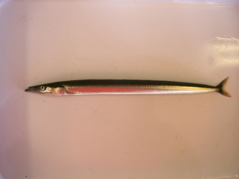
Lateral view of Hyperoplus lanceolatus.
Photographer: Hilmar Hinz Copyright: Dr Hilmar Hinz
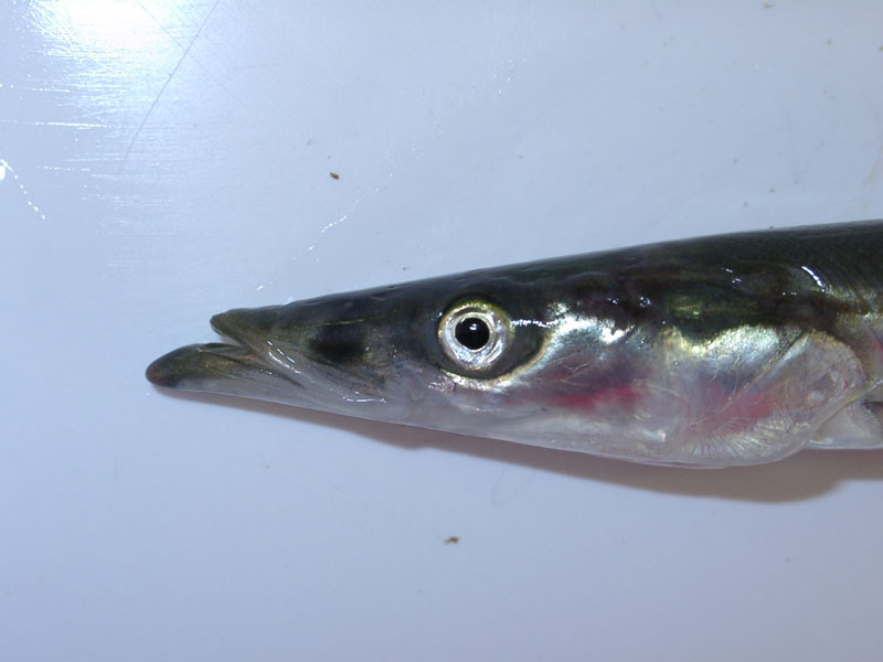
Head of Hyperoplus lanceolatus.
Photographer: Hilmar Hinz Copyright: Dr Hilmar Hinz
Distribution data supplied by the Ocean Biodiversity Information System (OBIS). To interrogate UK data visit the NBN Atlas.Map Help
| Researched by | Ana Ruiz | Refereed by | Admin |
| Authority | (Le Sauvage, 1824) | ||
| Other common names | - | Synonyms | - |
Summary
Description
Recorded distribution in Britain and Ireland
Widely distributed around Britain and Ireland.Global distribution
-Habitat
Found over clean sandy seabeds; from the shore down to about 150 m.Depth range
-Identifying features
- Silvery eel-like fish.
- Dark spot on each side of the snout.
- Two pointed teeth in the palate.
- Upper jaw not protractile.
- Forked tail.
Additional information
Spawning takes place in spring and summer over sandy grounds. The eggs stick to the sand grains. It feeds on small planktonic animals floating in the water and on worms, small crustaceans and small fish. It can be confused with Ammodytes tobianus, but greater sand eel is larger and individuals greater than 20 cm long are likely to be this species.Listed by
- none -
Bibliography
Dipper, F., 2001. British sea fishes (2nd edn). Teddington: Underwater World Publications Ltd.
Howson, C.M. & Picton, B.E., 1997. The species directory of the marine fauna and flora of the British Isles and surrounding seas. Belfast: Ulster Museum. [Ulster Museum publication, no. 276.]
Datasets
Environmental Records Information Centre North East, 2018. ERIC NE Combined dataset to 2017. Occurrence dataset: http://www.ericnortheast.org.ukl accessed via NBNAtlas.org on 2018-09-38
Fenwick, 2018. Aphotomarine. Occurrence dataset http://www.aphotomarine.com/index.html Accessed via NBNAtlas.org on 2018-10-01
Isle of Wight Local Records Centre, 2017. IOW Natural History & Archaeological Society Marine Records. Occurrence dataset: https://doi.org/10.15468/7axhcw accessed via GBIF.org on 2018-09-27.
Kent & Medway Biological Records Centre, 2017. Fish: Records for Kent. Occurrence dataset https://doi.org/10.15468/kd1utk accessed via GBIF.org on 2018-09-27.
National Trust, 2017. National Trust Species Records. Occurrence dataset: https://doi.org/10.15468/opc6g1 accessed via GBIF.org on 2018-10-01.
NBN (National Biodiversity Network) Atlas. Available from: https://www.nbnatlas.org.
OBIS (Ocean Biodiversity Information System), 2025. Global map of species distribution using gridded data. Available from: Ocean Biogeographic Information System. www.iobis.org. Accessed: 2025-08-08
Citation
This review can be cited as:
Last Updated: 17/04/2008
