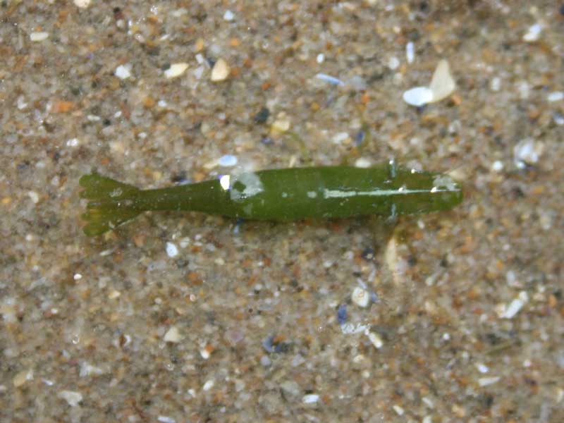
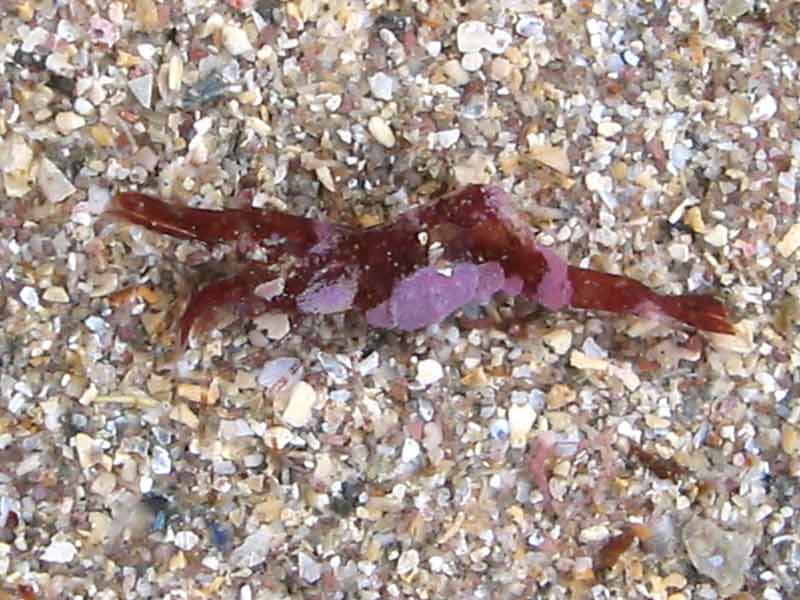
Chameleon prawn (Hippolyte varians)
Distribution data supplied by the Ocean Biodiversity Information System (OBIS). To interrogate UK data visit the NBN Atlas.Map Help
| Researched by | Sonia Rowley | Refereed by | Admin |
| Authority | Leach, 1814 [in Leach, 1813-1814] | ||
| Other common names | - | Synonyms | - |
Summary
Description
Recorded distribution in Britain and Ireland
Hippolyte varians is widely distributed around the coasts of Britain and Ireland, but is more commonly recorded in the south than north and probably under recorded.Global distribution
-Habitat
This species can be found in rock pools, gullies, amongst algae and Zostera beds from the lower shore down to 150 m depth.Depth range
-Identifying features
- Up to 3.2 cm in length.
- Variable in colour: red, brown, green, flecked reddish-brown, almost transparent with red and yellow blotches.
- The rostrum bears a single spine on its upper surface.
- A spine above each eye.
- The telson has two pairs of lateral spines.
Additional information
The chameleon prawn uses its variable colouration as camouflage during the day, but all turn a transparent bluish-green at night independent of habitat (Moen & Svensen, 2004). This species breeds throughout the year with increased intensity during the summer months. Hippolyte varians may be infected by the bopyrid isopod Bopyrina ocellata (Smaldon, 1993).The tufts of setae present on some individuals of Hippolyte varians led Gosse (1853) to classify it as a differenent species; Hippolyte fascigera. However, this was later invalidated by Chassard-Bouchard (Smaldon, 1993).
Listed by
- none -
Bibliography
Bruce, J.R., Colman, J.S. & Jones, N.S., 1963. Marine fauna of the Isle of Man. Liverpool: Liverpool University Press.
Crothers, J.H. (ed.), 1966. Dale Fort Marine Fauna. London: Field Studies Council.
Fish, J.D. & Fish, S., 1996. A student's guide to the seashore. Cambridge: Cambridge University Press.
Hayward, P., Nelson-Smith, T. & Shields, C. 1996. Collins pocket guide. Sea shore of Britain and northern Europe. London: HarperCollins.
Hayward, P.J. & Ryland, J.S. (ed.) 1995b. Handbook of the marine fauna of North-West Europe. Oxford: Oxford University Press.
Howson, C.M. & Picton, B.E., 1997. The species directory of the marine fauna and flora of the British Isles and surrounding seas. Belfast: Ulster Museum. [Ulster Museum publication, no. 276.]
MBA (Marine Biological Association), 1957. Plymouth Marine Fauna. Plymouth: Marine Biological Association of the United Kingdom.
Moen, F.E. & Svensen, E., 2004. Marine Fish & Invertebrates of Northern Europe. Southend-on-Sea: Aqua Press.
Picton, B.E. & Costello, M.J., 1998. BioMar biotope viewer: a guide to marine habitats, fauna and flora of Britain and Ireland. [CD-ROM] Environmental Sciences Unit, Trinity College, Dublin.
Smaldon, G., 1993. Coastal Shrimps and Prawns. The Linnean Society of London. Shrewsbury: Field Studies Council. [Synopses of the British Fauna No. 15. 2nd Ed.)]
Datasets
Centre for Environmental Data and Recording, 2018. Ulster Museum Marine Surveys of Northern Ireland Coastal Waters. Occurrence dataset https://www.nmni.com/CEDaR/CEDaR-Centre-for-Environmental-Data-and-Recording.aspx accessed via NBNAtlas.org on 2018-09-25.
Fenwick, 2018. Aphotomarine. Occurrence dataset http://www.aphotomarine.com/index.html Accessed via NBNAtlas.org on 2018-10-01
Fife Nature Records Centre, 2018. St Andrews BioBlitz 2015. Occurrence dataset: https://doi.org/10.15468/xtrbvy accessed via GBIF.org on 2018-09-27.
Isle of Wight Local Records Centre, 2017. IOW Natural History & Archaeological Society Marine Invertebrate Records 1853- 2011. Occurrence dataset: https://doi.org/10.15468/d9amhg accessed via GBIF.org on 2018-09-27.
Kent Wildlife Trust, 2018. Biological survey of the intertidal chalk reefs between Folkestone Warren and Kingsdown, Kent 2009-2011. Occurrence dataset: https://www.kentwildlifetrust.org.uk/ accessed via NBNAtlas.org on 2018-10-01.
Kent Wildlife Trust, 2018. Kent Wildlife Trust Shoresearch Intertidal Survey 2004 onwards. Occurrence dataset: https://www.kentwildlifetrust.org.uk/ accessed via NBNAtlas.org on 2018-10-01.
NBN (National Biodiversity Network) Atlas. Available from: https://www.nbnatlas.org.
OBIS (Ocean Biodiversity Information System), 2025. Global map of species distribution using gridded data. Available from: Ocean Biogeographic Information System. www.iobis.org. Accessed: 2025-08-08
South East Wales Biodiversity Records Centre, 2018. SEWBReC Myriapods, Isopods, and allied species (South East Wales). Occurrence dataset: https://doi.org/10.15468/rvxsqs accessed via GBIF.org on 2018-10-02.
Yorkshire Wildlife Trust, 2018. Yorkshire Wildlife Trust Shoresearch. Occurrence dataset: https://doi.org/10.15468/1nw3ch accessed via GBIF.org on 2018-10-02.
Citation
This review can be cited as:
Last Updated: 08/05/2008


