Atlantic mackerel (Scomber scombrus)
Distribution data supplied by the Ocean Biodiversity Information System (OBIS). To interrogate UK data visit the NBN Atlas.Map Help
| Researched by | Morvan Barnes | Refereed by | Admin |
| Authority | Linnaeus, 1758 | ||
| Other common names | - | Synonyms | - |
Summary
Description
Recorded distribution in Britain and Ireland
Widely distributed in the continental shelf seas around the British Isles and Ireland, usually at depths of less than 200 m. Found in greater abundance on the shelf edges during winter.Global distribution
-Habitat
Atlantic mackerel is a pelagic species that makes extensive migrations, and there are a variety of hydrographical features such as temperatures as well as the abundance and composition of zooplankton and other prey is likely to affect its distribution. Scomber scombrus can be extremely common and found in huge shoals feeding on small fish and prawns.Depth range
-Identifying features
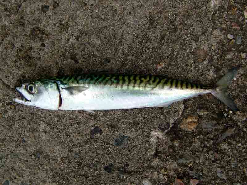
- Fast, streamline, fish usually found in dense shoals.
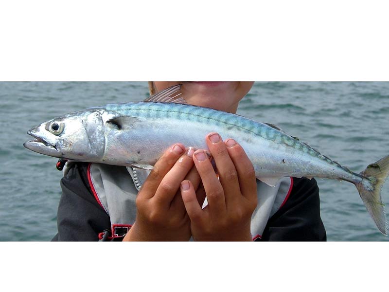
- At full length Atlantic mackerel may reach over 60 cm in length and 3.4 kg in weight.
- Strong dark markings on the back which are oblique to near straight in orientation.
- Unmarked belly, silver to metallic blue in colour.
Additional information
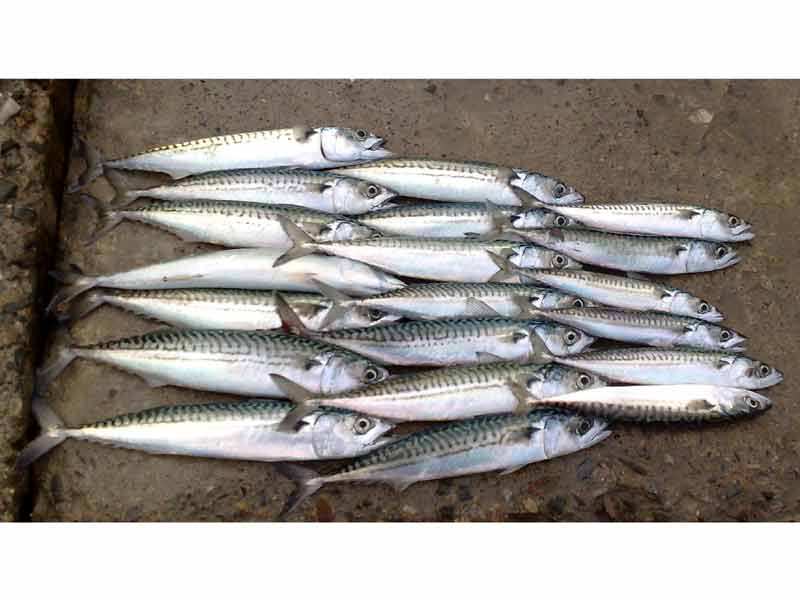
Shoals up to 9 km long, 4 km wide and extending 40 m deep have been reported. This species is a highly commercial species for trawlers but is also targeted by anglers and sport fishers (Lockwood, 1988).
A similar species, the Scomber japonicus, is also found in the English Channel during the summer. The species are distinguished by five small finlets between the second dorsal and tail fin, and between the anal fin and the tail of Scomber japonicus (Knijn et al., 1993).
Listed by
Bibliography
Collette, B.B. & Nauen, C.E., 1983. FAO species catalogue. Vol. 2. Scombrids of the World. An Annotated and Illustrated Catalogue of Tunas, Mackerels, Bonitos and Related Species Known to Date. Food and Agriculture Organization of the United Nations (FAO) Fisheries Synopsies, 125
Froese, R. & Pauly, D., 2007. Fishbase. A global information system on fishes. [On-line] http://www.fishbase.org, 2008-02-18
Howson, C.M. & Picton, B.E., 1997. The species directory of the marine fauna and flora of the British Isles and surrounding seas. Belfast: Ulster Museum. [Ulster Museum publication, no. 276.]
Iversen, S.A. & Ljoeen, R., 1985. The Spawning and Distribution of Mackerel Eggs in the North Sea related to the Hydrography. ICES report. CM 1985/H:35., ICES
Knijn, R.J., Boon, T.W., Heesen, H.J.L & Hislop, J.R.G., 1993. Atlas of North Sea Fishes. ICES cooperative research reports. ICES 194., Copenhagen
Lockwood, S.J., 1988. The mackerel. It's biology, assessment and the management of a fishery.
Moen, F.E. & Svensen, E., 2004. Marine Fish & Invertebrates of Northern Europe. Southend-on-Sea: Aqua Press.
Picton, B.E. & Costello, M.J., 1998. BioMar biotope viewer: a guide to marine habitats, fauna and flora of Britain and Ireland. [CD-ROM] Environmental Sciences Unit, Trinity College, Dublin.
Whitehead, P.J.P., Bauchot, M.-L., Hureau, J.-C., Nielson, J. & Tortonese, E. 1986. Fishes of the North-eastern Atlantic and the Mediterranean. Vol. I, II & III. Paris: United Nations Educational, Scientific and Cultural Organisation (UNESCO).
Datasets
Cofnod – North Wales Environmental Information Service, 2018. Miscellaneous records held on the Cofnod database. Occurrence dataset: https://doi.org/10.15468/hcgqsi accessed via GBIF.org on 2018-09-25.
Environmental Records Information Centre North East, 2018. ERIC NE Combined dataset to 2017. Occurrence dataset: http://www.ericnortheast.org.ukl accessed via NBNAtlas.org on 2018-09-38
Fenwick, 2018. Aphotomarine. Occurrence dataset http://www.aphotomarine.com/index.html Accessed via NBNAtlas.org on 2018-10-01
Isle of Wight Local Records Centre, 2017. IOW Natural History & Archaeological Society Marine Records. Occurrence dataset: https://doi.org/10.15468/7axhcw accessed via GBIF.org on 2018-09-27.
Kent & Medway Biological Records Centre, 2017. Fish: Records for Kent. Occurrence dataset https://doi.org/10.15468/kd1utk accessed via GBIF.org on 2018-09-27.
Lancashire Environment Record Network, 2018. LERN Records. Occurrence dataset: https://doi.org/10.15468/esxc9a accessed via GBIF.org on 2018-10-01.
Merseyside BioBank., 2018. Merseyside BioBank (unverified). Occurrence dataset: https://doi.org/10.15468/iou2ld accessed via GBIF.org on 2018-10-01.
National Trust, 2017. National Trust Species Records. Occurrence dataset: https://doi.org/10.15468/opc6g1 accessed via GBIF.org on 2018-10-01.
NBN (National Biodiversity Network) Atlas. Available from: https://www.nbnatlas.org.
Norfolk Biodiversity Information Service, 2017. NBIS Records to December 2016. Occurrence dataset: https://doi.org/10.15468/jca5lo accessed via GBIF.org on 2018-10-01.
OBIS (Ocean Biodiversity Information System), 2025. Global map of species distribution using gridded data. Available from: Ocean Biogeographic Information System. www.iobis.org. Accessed: 2025-08-15
Outer Hebrides Biological Recording, 2018. Vertebrates (except birds, INNS and restricted records), Outer Hebrides. Occurrence dataset: https://doi.org/10.15468/dax3tf accessed via GBIF.org on 2018-10-01.
South East Wales Biodiversity Records Centre, 2018. SEWBReC Fish (South East Wales). Occurrence dataset: https://doi.org/10.15468/htsfiy accessed via GBIF.org on 2018-10-02.
Citation
This review can be cited as:
Last Updated: 27/03/2008


