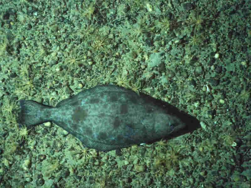
Greenland halibut (Reinhardtius hippoglossoides)
Distribution data supplied by the Ocean Biodiversity Information System (OBIS). To interrogate UK data visit the NBN Atlas.Map Help
| Researched by | Morvan Barnes | Refereed by | Admin |
| Authority | (Walbaum, 1792) | ||
| Other common names | - | Synonyms | - |
Summary
Description
Recorded distribution in Britain and Ireland
Usually restricted to waters further north it has been observed in the North Sea and has also been found off the western and northern coasts of Ireland.Global distribution
-Habitat
A truly marine and benthopelagic species, which may be found down to a depth of 2000 m.Depth range
-Identifying features
- A right-handed flatfish.
- Up to 120 cm in length.
- Yellowish or grayish brown in colour.
- Smoothly curved and symmetrical ventral fins.
- With a notably large mouth.
- Straight lateral line.
Additional information
No text enteredListed by
Bibliography
Froese, R. & Pauly, D., 2007. Fishbase. A global information system on fishes. [On-line] http://www.fishbase.org, 2008-02-18
Howson, C.M. & Picton, B.E., 1997. The species directory of the marine fauna and flora of the British Isles and surrounding seas. Belfast: Ulster Museum. [Ulster Museum publication, no. 276.]
Nielsen, J.G., 1986. Pleuronectidae. UNESCO, Paris.
Quigley, D.T.G., Flannery, K. & O'Shea, J., 1989. Specimens of the greenland halibut Reinhardtius (Walbaum 1792) from Irish waters. Irish Naturalists' Journal, 23, 111-112
Whitehead, P.J.P., Bauchot, M.-L., Hureau, J.-C., Nielson, J. & Tortonese, E. 1986. Fishes of the North-eastern Atlantic and the Mediterranean. Vol. I, II & III. Paris: United Nations Educational, Scientific and Cultural Organisation (UNESCO).
Datasets
Centre for Environmental Data and Recording, 2018. Ulster Museum Marine Surveys of Northern Ireland Coastal Waters. Occurrence dataset https://www.nmni.com/CEDaR/CEDaR-Centre-for-Environmental-Data-and-Recording.aspx accessed via NBNAtlas.org on 2018-09-25.
NBN (National Biodiversity Network) Atlas. Available from: https://www.nbnatlas.org.
OBIS (Ocean Biodiversity Information System), 2025. Global map of species distribution using gridded data. Available from: Ocean Biogeographic Information System. www.iobis.org. Accessed: 2025-08-15
Citation
This review can be cited as:
Last Updated: 24/06/2008


