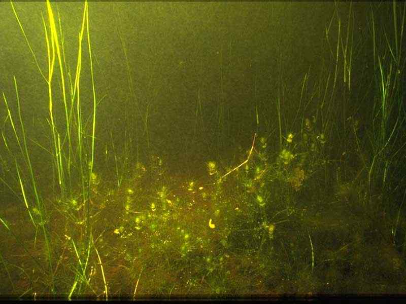
Foxtail stonewort (Lamprothamnium papulosum)
Distribution data supplied by the Ocean Biodiversity Information System (OBIS). To interrogate UK data visit the NBN Atlas.Map Help
| Researched by | Penny Avant | Refereed by | Admin |
| Authority | (K.Wallroth) J.Groves, 1916 | ||
| Other common names | - | Synonyms | - |
Summary
Description
Recorded distribution in Britain and Ireland
Found in Dorset (The Fleet), Fort Gilkicker Moat (Hampshire), Harbour Farm Lagoons, Bembridge (Isle of Wight), Great Deep (West Sussex) and in 9 saline lagoons in the Outer Hebrides. Extinct populations recorded from Dorset and the Isle of White.Global distribution
Sporadic distribution in suitable habitats around the European coast from Norway, the Batlic to the Iberian Peninsula and the Mediterranean to Greece and Italy. Also recorded from isolated populations in southern Africa and Australia.Habitat
Found in fairly still, brackish, nutrient-poor water on sand, gravel, small pebbles and silty substrata. Lamprothamnium papulosum usually grows in water of fluctuating salinity less than 2 m deep, and is often associated with Ruppia maritima or Ruppia cirrhosa communities. This stonewort prefers water of salinities of between 8-28 psu, or 6 gl-1 to 31 gl-1 and total phosphorus lower than 103 g l-. Variation in salinity appears to be important, with >15 gl-1 (24-28 ppt) being optimal for vegetative growth, with a salinity range of > 4 gl-1. Lamprothamnium papulosum has also been recorded from hypersaline conditions in Spain (Jonkers et al., 2003) and Australia (Davis & Lipkin, 1986).Some disturbance by livestock/animals may benefit Lamprothamnium papulosum by reducing competitive vascular plants. Habitats for Lamprothamnium papulosum may be transient, due to salinity fluctuations or desiccation in the absence of rainfall/freshwater inputs. Lamprothamnium papulosum is able to quickly recolonize from the spore bank when suitable conditions reoccur. However the saline lagoons habitat itself is rare and threatened.
Depth range
-Identifying features
- Thin, upright stems up to 40 cm in height, anchored in the sediment by rhizoids.
- Whorls of spine-like leaves at regular intervals.
- Whorls closer together at the top of the stem, giving a bushy 'foxtail' appearance.
Additional information
Often found associated with Ruppia maritima or Ruppia cirrhosa communities. Lamprothamnium papulosum appears to be declining throughout its range and is vulnerable to habitat destruction. It is listed as 'Vulnerable' in the British Red Data Book. The Hebridean populations were discovered since Lamprothamnium papulosum was listed in the British Red Data Book.Listed by
Bibliography
Anonymous, 1999v. Lamprothamnium papulosum. Species statement. In UK Biodiversity Group. Tranche 2 Action Plans. English Nature for the UK Biodiversity Group, Peterborough., English Nature for the UK Biodiversity Group, Peterborough., http://www.ukbap.org.uk/plans/habitats/NBNSYS0000004643.htm
JNCC (Joint Nature Conservation Committee), 1999. Marine Environment Resource Mapping And Information Database (MERMAID): Marine Nature Conservation Review Survey Database. [on-line] http://www.jncc.gov.uk/mermaid
Parke, M. & Dixon, P.S., 1976. Check-list of British Marine Algae - Third Revision. Journal of the Marine Biological Association of the United Kingdom, 56, 527-594.
Stewart, N.F. & Church, J.M., 1992. Red data books of Britain and Ireland: stoneworts. Peterborough: The Joint Nature Conservation Committee
Datasets
Botanical Society of Britain & Ireland, 2018. Other BSBI Scottish data up to 2012. Occurrence dataset: https://doi.org/10.15468/2dohar accessed via GBIF.org on 2018-09-25.
Isle of Wight Local Records Centre, 2017. Isle of Wight Notable Species. Occurrence dataset: https://doi.org/10.15468/sm4ety accessed via GBIF.org on 2018-09-27.
NBN (National Biodiversity Network) Atlas. Available from: https://www.nbnatlas.org.
OBIS (Ocean Biodiversity Information System), 2025. Global map of species distribution using gridded data. Available from: Ocean Biogeographic Information System. www.iobis.org. Accessed: 2025-08-01
Royal Botanic Garden Edinburgh, 2018. Royal Botanic Garden Edinburgh Herbarium (E). Occurrence dataset: https://doi.org/10.15468/ypoair accessed via GBIF.org on 2018-10-02.
Citation
This review can be cited as:
Last Updated: 27/05/2004


